
On the Edge of the Great Blue Pacific
TEXT / RICK CHARETTE
PHOTOS / CHEN CHENG-KUO, ASKA CHI
What sorts of healthy, invigorating active-fun pleasures will fill your days spent along the visually spectacular Northeast Coast, the expanse of the mighty Pacific laid out before you, wall of young and still quickly growing mountains close in behind? Hiking breeze-swept capes jutting out into the sea. Snorkeling or scuba diving in placid bays. Ocean swimming. Clambering among strange nature-carved rock artworks. Rock climbing on coastal cliffs. Stand-up paddleboarding. Rail biking. Inland and coast-side cycling. River and sea kayaking. Surfing ….
Any – or all – catch your fancy? Let’s head on out!
The Northeast Coast stretches from just east of the harbor city of Keelung to just north of the town of Toucheng, which sits in the northeast corner of the wide-mouthed, ocean-facing Yilan Plain in Yilan County. In this article, all of the sites visited are within the boundaries of New Taipei City. All, save for the first few, are within the Northeast and Yilan Coast National Scenic Area, which is overseen by the Taiwan Tourism Bureau.
This dramatically scenic region is characterized by bay after bay and by prominent capes, backed by a wall of verdant mountains, their steep sides dropping right to the water in many places. Its attractions include fantastic rock formations, distinctive sea-eroded landforms, beaches of soft golden sand, a bountiful diversity of marine life, and an unspoiled cultural heritage. This is a multipurpose tourist destination that serves the dual functions of a fascinating natural classroom and an enchanting coastal playground.
Our main focus in this article is the “playground” role, with outdoor active fun given the starring role. New freeway building in the past two decades has made access easy from the densely populated Taipei Basin, and on weekends and holidays the Northeast Coast is busy along its entire length. Yet during the week and non-holiday periods you can easily find yourself almost or completely alone in many locations during an exploratory meandering.
We launch our tour with a breezy rail-bike ride along the shore at a place called Shen’ao, immediately east of Keelung City, and end with an exhilarating (yet easy-grade) hike atop Sandiao Cape, the island of Taiwan’s easternmost point, and a visit to quaint Mao’ao village, an old fishing settlement tucked against the cape’s base on its north side.
Almost all sites visited are right along Provincial Highway 2, the coastal highway – except for two villages, Jiufen and Jinguashi, which look down at you from up on mountain slopes above the highway. Cycling enthusiasts take note that the highway is wide, with gradients moderate, and with wide shoulders put in specifically to accommodate cyclists. Bike rentals are available at two sites visited, Shen’ao and Fulong village.
Content
Chaojing Park
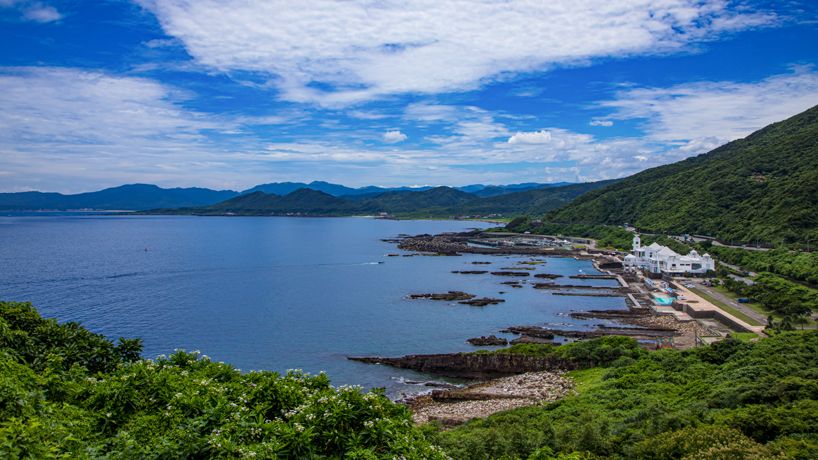
Breeze-swept Chaojing Park takes up the northeast corner of the Badouzi Peninsula, which is located just west of the Shen’ao area visited at the beginning of this article. If starting your coastal exploratory foray from the central port area of Keelung City, this will be the first of this article’s scenic sights that you come to.
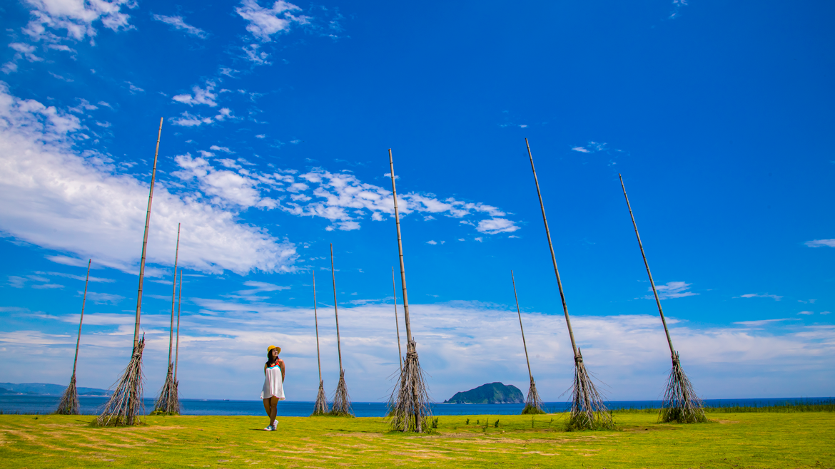
The main area of this young park is wide open, almost treeless, creating pretty much perfect conditions for kite-flyers. The open area is backed by cliffs, with a staircase pathway taking you to the top. At low tide a wide intertidal zone opens up, busy with little marine creatures – this zone, for understandable reason, is park destination no. 1 with kids. Wanghaixiang Bay, on the east, offers fine scuba-diving and snorkeling, and along the short road up from the coastal highway to the park’s grassy-top area you’ll invariably pass by groups of underwater-fun enthusiasts and their guides suiting up or just returning.
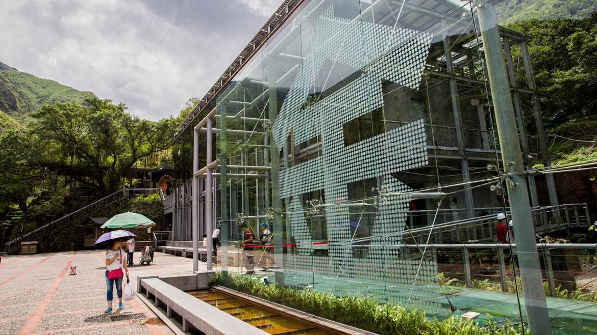
This attraction is designed as a marine-education park. Just inside its entrance is the Chaojing Ocean Center, which has quality displays on the local marine ecology. The facility is associated with the prestigious National Museum of Marine Science and Technology located nearby. Throughout the park are installation artworks with a marine theme, such as a giant shell and fast-swimming school of stylized-form fish, and also dotting the grounds are signboards with interesting Chinese/English information on the local marine ecology.
The views from the outer edge of the park – the grassy area – are tremendous. There is too much to capture with single photos; you’ll regret it if you don’t go home with a slow 360-degree video pan. Facing east, on the other side of the bay is the shore-crowding mass of Mt. Jilong and, spread out below a ridgeline leading inland from it, the painting-perfect town of Jiufen. Facing west, ships can be seen entering and exiting Keelung City’s tight, deep, mountain-bracketed main harbor. If time allows, walk from Chaojing Park to the pretty V-shaped Wangyou Valley in the peninsula’s center, sliced through by one of north Taiwan’s most picturesque trails.
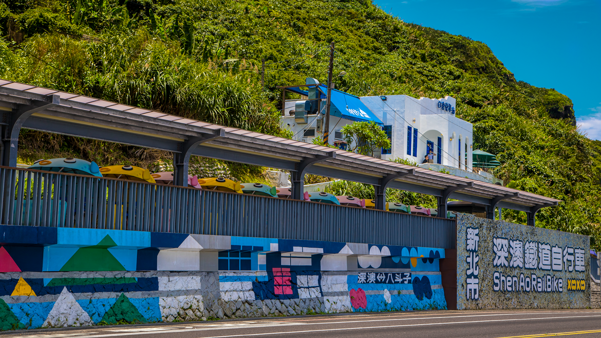
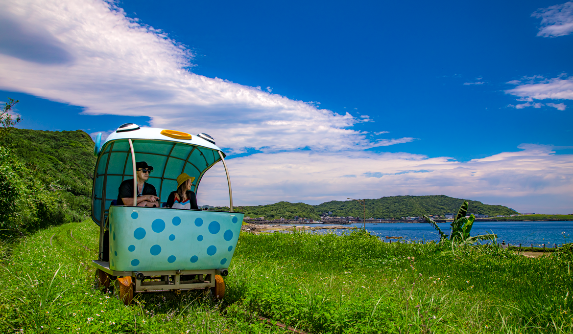
Shen’ao Rail Bike
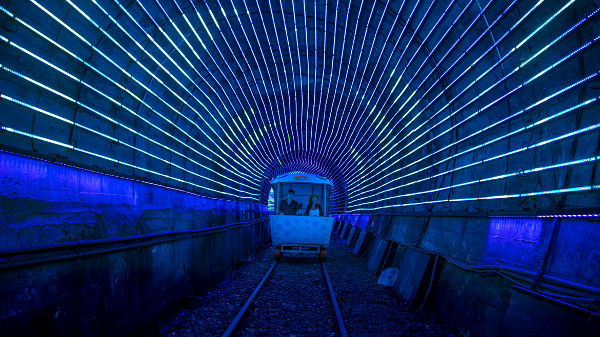
The popular Shen’ao Rail Bike experience, on which the curtains were raised in 2018, takes you 1.3km along once-abandoned tracks between Badouzi Station on the west, near Chaojing Park, and Shen’ao Station on the east. You ride in cutesy slow-pedal cars that fit two people each along the coast, with grand views of Chaojing Park, the rocky shore of Wanghaixiang Bay, and fishing craft heading into and out of the small Wanghaixiang Fishing Harbor. About half-way along you enter a tunnel to pierce through a mountain spur; a dreamlike experience awaits inside, with the walls lit up to create the feel of traveling under the sea, marine creatures drifting by beside and above you. On exit you’re presented with a leafy forest scene in a narrow valley, passing by the imposing concrete ruins of a defunct coal-mining operation before arriving at the Shen’ao Station terminus.
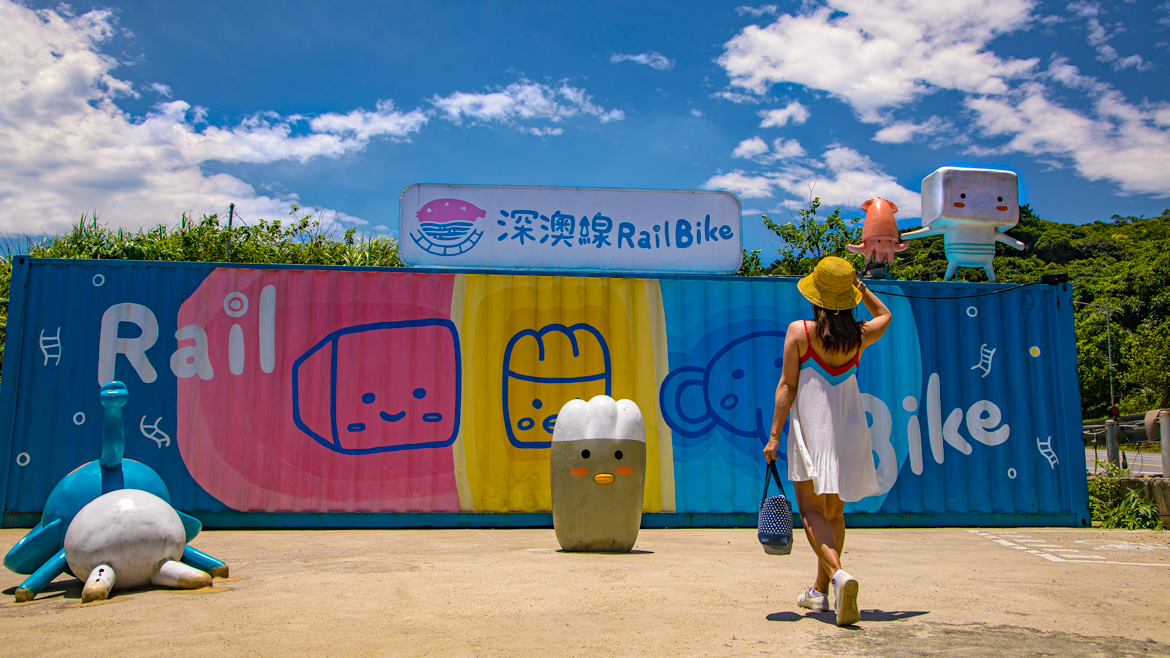
The tracks you ride were once part of the Shen’ao Branch Line, stretching from Badouzi along the coast to Shuinandong village, below the mountainside mining town of Jinguashi (to be visited in a moment). The line was created to carry coal, and also carried local passengers and freight.
Shen’ao Rail Bike (深澳鐵道自行車)
Add: No. 121, Sec. 2, Jianji Rd., Ruifang District, New Taipei City
(新北市瑞芳區建基路二段121號)
Tel: (02) 2406-2200
Ticket: NT$150 (one-way)
Website: www.railbike.com.tw (Chinese)
HOHObase
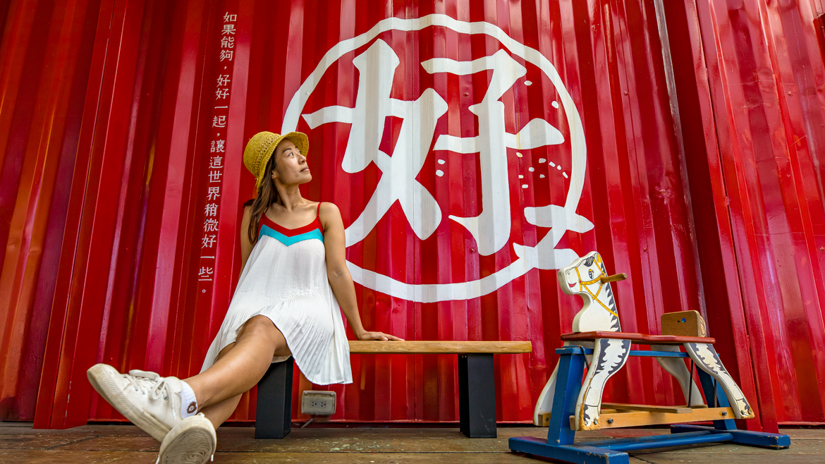
About 200m out of Badouzi Station your rail-bike putt-putt car passes by the HOHObase, a café/restaurant sandwiched between tracks and coastal highway. “Through” might be the better term, as you’ll see. Placed around a small lawn in an “L” shape are a number of painted cargo containers. On the ground, inside one is a dining area, inside the other the kitchen and a tiny retail shop. Spanning the gap between the two, stacked atop, is a third container, which serves as a combo dining area and art gallery highlighting local talent. On all three glass is used liberally on two sides, allowing the superb ocean vista to flood in. There are also two small, renovated structures across the tracks, one the owner’s home, the other soon to be a dedicated art gallery.
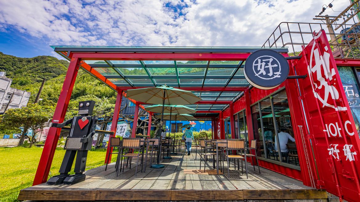
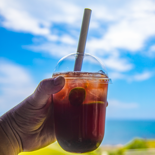
The owner, an amiable fellow with the look of a one-time-hippie turned entrepreneur, soothes customers with recorded ’60s/’70s Western folk and blues. The menu teases you with a wide range of non-alcoholic/alcoholic beverages, sandwiches, salads, and desserts.
HOHObase (好好基地)
Add: No. 93, Sec. 2, Jianji Rd., Ruifang District, New Taipei City
(新北市瑞芳區建基路二段93號)
Website: hohobase.business.site (Chinese)
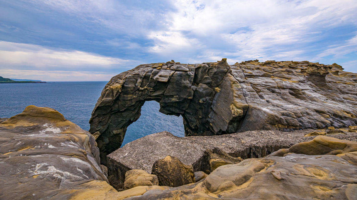
Elephant Trunk Rock
This photogenic sea arch, a popular Instagram spot, is near the tip of the Shen’ao Promontory. On the west of the narrow, rocky promontory is Wanghaixiang Bay, on the east Shen’ao Bay. Along the way to the headland tip of the promontory you pass by the Shen’ao Fishing Harbor, spread out along the Shen’ao Bay side, which during the day is densely packed with boats. Most craft here are involved with nighttime fishing for neritic squid, a key catch in the Keelung region. Identifying these vessels is easy – look for the prominent long strings of large lightbulbs along the sides. Their powerful light draws the squid to the surface.
The headland area, which starts right at the seaward edge of the fishing settlement, is reserved as a park. You reach Elephant Trunk Rock by making your way along the wide natural stone platform on the Shen’ao Bay side, then navigating a short, steep dirt path to the headland’s top, which puts the pachyderm in view directly before you. The platform is a veritable geo-classroom, rife with the type of intriguing rock formations found at rugged points all along this coast – mushroom rock, honeycomb rock, beancurd rock, and cuesta formations. The arch clearly resembles an elephant, right down to the gray coloration, with its trunk extending downward into the crashing sea as if the giant petrified animal has paused here for a cooling drink, and a big floppy ear behind the head. While atop the headland, also note the abandoned pillboxes; this was formerly an off-limits military zone.
Related article
Mt. Shen’ao and ELEPHANT TRUNK ROCK
Shen’ao Fishing Harbor
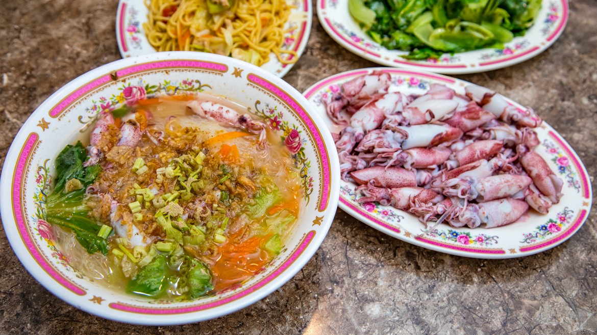
Be sure to spend time in the harbor area as well. The one road along the promontory to the park brings you within feet of many craft, and you can get an up-close look at crews handling catch, nets, and so on. Just beyond the village, on the headland’s Wanghaixiang Bay side, is Shen’ao’s other famed rock-art formation, the (Indian) Chief’s Head Rock, which resembles a native American tribal leader in traditional headdress. The best of the various local seafood eateries is Chang Rong Xiao Juan, a tiny, tidy spot hardly bigger inside than a normal-sized living room. Its offerings are ultra-fresh; the owner-family operate their own fishing craft. Specially recommended are the blanched neritic squid with wasabi sauce and in vermicelli soup.
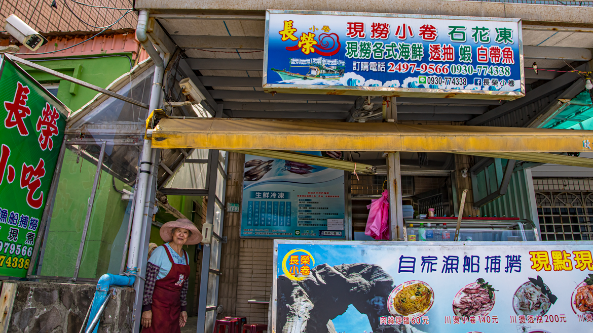
Chang Rong Xiao Juan (長榮小卷)
Add: No. 153, Shen’ao Rd., Ruifang District, New Taipei City
(新北市瑞芳區深澳路153號)
Tel: 0930-774-338
Facebook: www.facebook.com/long.glory.26
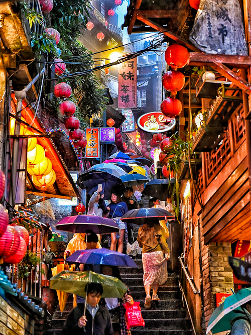
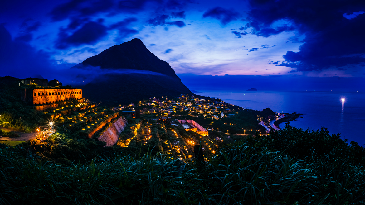
Jiufen
The coastal region immediately to the south and east of central Keelung City has a rich cluster of one-time mining settlements, tourism the moneymaker today, among which the most picturesque and celebrated is Jiufen, which from a distance seems to cling to a mountainside in gravity-defying fashion, overlooking the ocean. It’s main attraction is Jiufen Old Street, barely wide enough for more than three people to pass by each other, which is lined with stalls and eateries selling specialty food treats, souvenir craft shops, and quaint teahouses in heritage buildings with grand ocean views (some with outdoor seating). Signature Jiufen treats include taro balls, fish balls, pork jerky, and tea eggs.
The heritage Shengping Theater, close to the Old Street, was in times past the main entertainment venue in a town dubbed “Little Shanghai.” Now renovated, visitors can view such period adornments as old movie posters, cinema equipment, and a well-preserved concession stand.
Be sure to leave time to conquer mighty Mt. Jilong, which soars 587m high and stands between the town and the sea. The trailhead is just a few hundred meters uphill from the intersection of Jiufen Old Street and the main thoroughfare, County Highway 102. The steep, shadeless path to the peak ends with incredible mountain/ocean panoramas.
Jinguashi
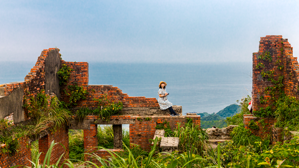
Jiufen’s next-door neighbor is Jinguashi, another former mining enclave, which also overlooks the sea. It sits high in a sharply sloping valley that runs along the east side of Mt. Jilong. Spread out around the top of the village is a cluster of heritage attractions that constitute the open-air Gold Museum. This valley was site of the infamous WW II Kinkaseki POW Camp, where Allied prisoners were forced to work the mines.
Among the many Gold Museum draws is the Benshan Fifth Tunnel, an old mineshaft open for guided tours. The Gold Building has informative exhibits on miners and the history of the local mines, including on the Kinkaseki operation. Visitors also thrill at the chance to put hands on the world’s largest gold ingot, weighing in at 220.3 kilograms. The highlight experience at the Gold Refining Building is an animation, projected 180 degrees, that evokes the atmosphere of the heady days of gold prospecting. The Crown Prince Chalet is a Japanese-style wood building built in 1922 for a visit by the future Emperor Hirohito that never happened.
Gold Museum (黃金博物館)
Add: No. 8, Jinguang Rd., Jinguashi, Ruifang District, New Taipei City
(新北市瑞芳區金瓜石金光路8號)
Tel: (02) 2496-2800
Facebook: www.gep.ntpc.gov.tw
Also nearby the village is the Jinguashi Geopark, rich with signboards explaining a wide range of area geology-related matters, from metamorphism to the major rock formations in view to the different types of yesteryear mining tools used.
The steep Liukeng Slope Ropeway is a vestige of the narrow-gauge rail system used to bring ore down the valley for smelting at the massive Shuinandong Smelter (see next section).
After working up a thirst and hunger pangs moving around among these spots, sit down for a spell at one of the local cafés, which serve up fine views. The Golden Impression Café, which has outdoor seating, is on a small plaza overlooking the valley. It has both Western and Taiwanese offerings, among the most unusual being the Mineworkers’ Lunch Box and peach Oolong tea.
Golden Impression Café (黃金印象義式餐廳)
Add: No. 8-1, Jinguang Rd., Jinguashi, Ruifang District, New Taipei City
(新北市瑞芳區金光路8-1號)
Tel: (02) 2496-2898
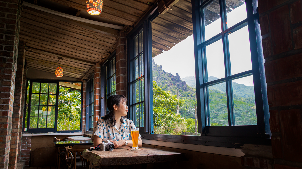
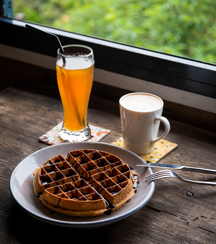
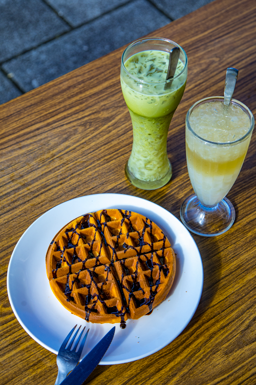
Café & Me, located high up on the valley’s side above the village, is in a renovated cottage-style abode percolating with period and retro-style adornments. The two bestselling food items here are the curry chicken with rice and the waffles.
Café & Me
Add: No. 99, Qitang Rd., Jinguashi, Ruifang District, New Taipei City
(新北市瑞芳區祈堂路99號)
Tel: (02) 2496-2033
Facebook: www.facebook.com/pages/Cafe-Me/1424489924431421
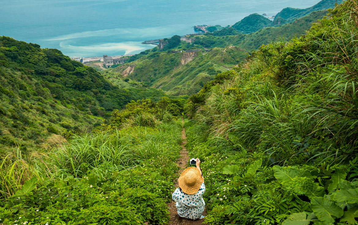
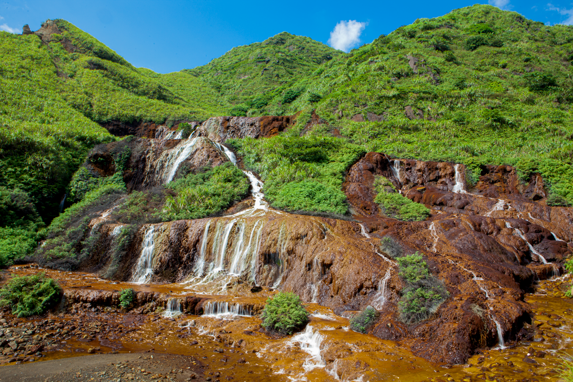
Shuinandong
Toward the bottom of the valley, the Shuinandong Smelter looms high above the coastal highway, which crosses the valley mouth. The hulking, abandoned behemoth is today also called the Remains of the 13 Levels. It was built by the Japanese in 1933 for copper and gold smelting. Nearby is the brilliant Golden Waterfall; the exposed bedrock and great boulders in the stream here have a striking golden-orange hue, colored by leached metals in the water. At their mountain journey’s end the metal-heavy waters pour into a shallow bay, painting it in a swirling blue-and-yellow duet that has spawned the name Yin Yang Sea.
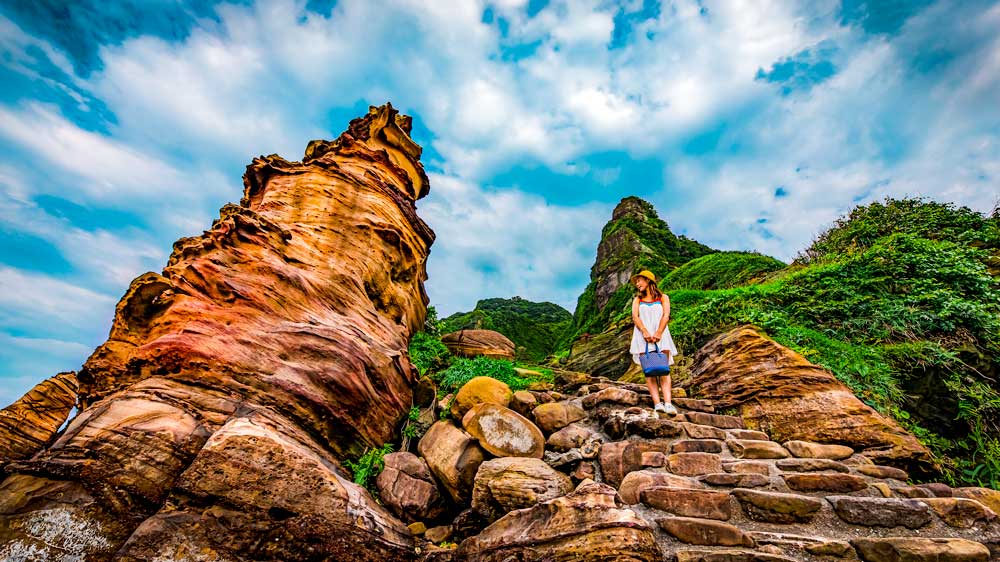
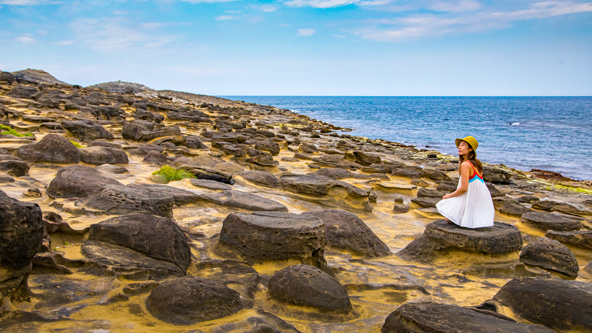
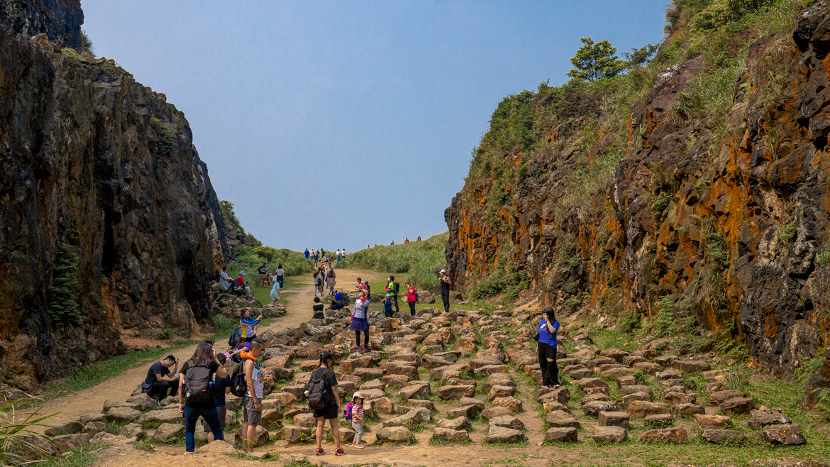
Nanya Rocks
The fantastic contorted formations called the Nanya Rocks, located near the small fishing village of Nanya, are one of the Northeast Coast’s most iconic geological features. They extend from highway-side to ocean’s edge, along a road section hundreds of meters long. On the inland side of the highway are steep cliffs, powerfully heightening the visual drama. A pathway with boardwalk sections, about 300m long, stretches along the shore area from the fishing village to the rock formations; called the Nanya Geological Hiking Trail, it facilitates an easy traverse of the rugged terrain and up-close looks at many of the natural artworks.
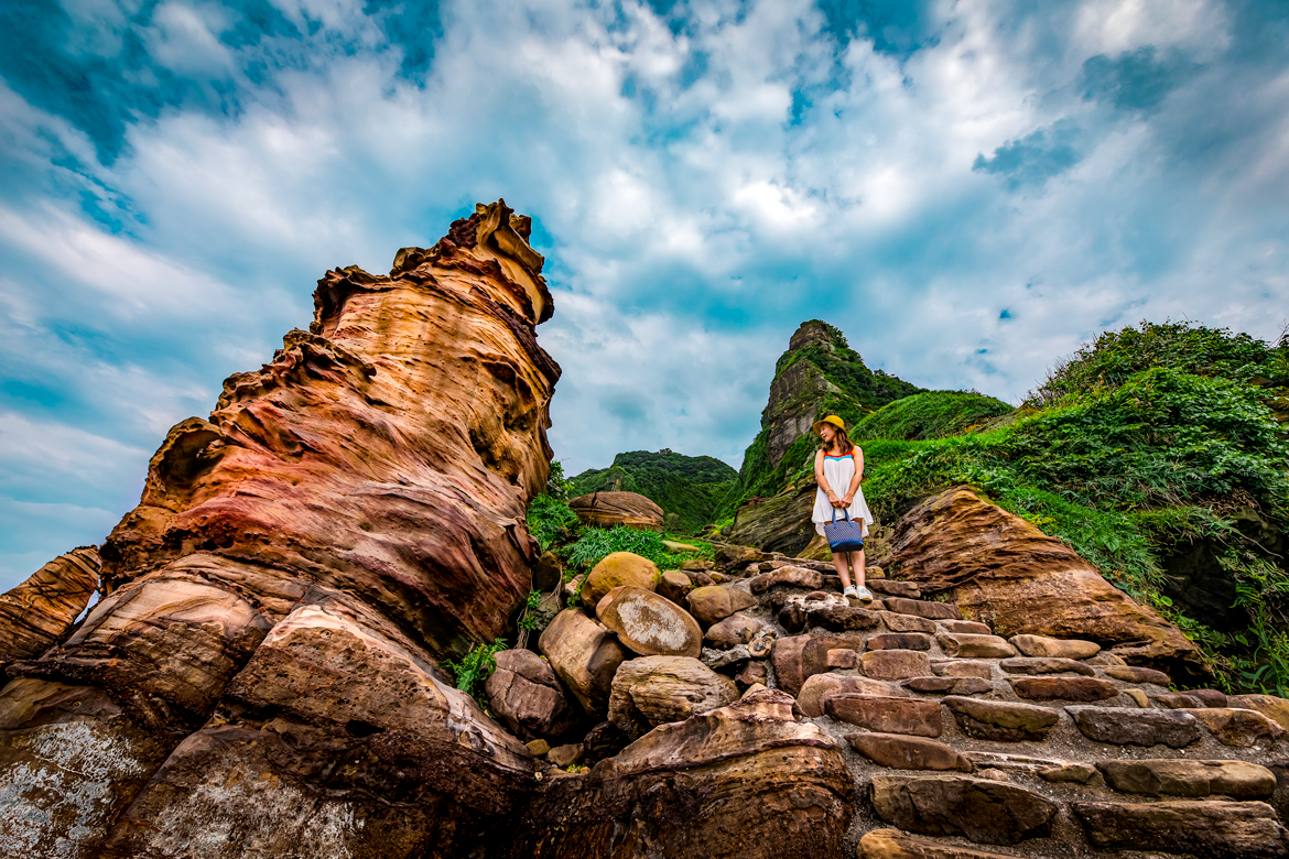
The mesmerizing diversification of the platform-type geological landscape here is the result of differential wind and water erosion of the exposed rock-layer striations, which are of different hardness and thickness. Sandstone is predominant, with iron-rich striations in between of a rusty hue. Test your spotting skills by hunting for three of the most photographed formations: the Ice Cream Rock, Bamboo Shoot Rock, and Fur Seal Rock.
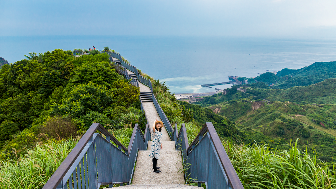
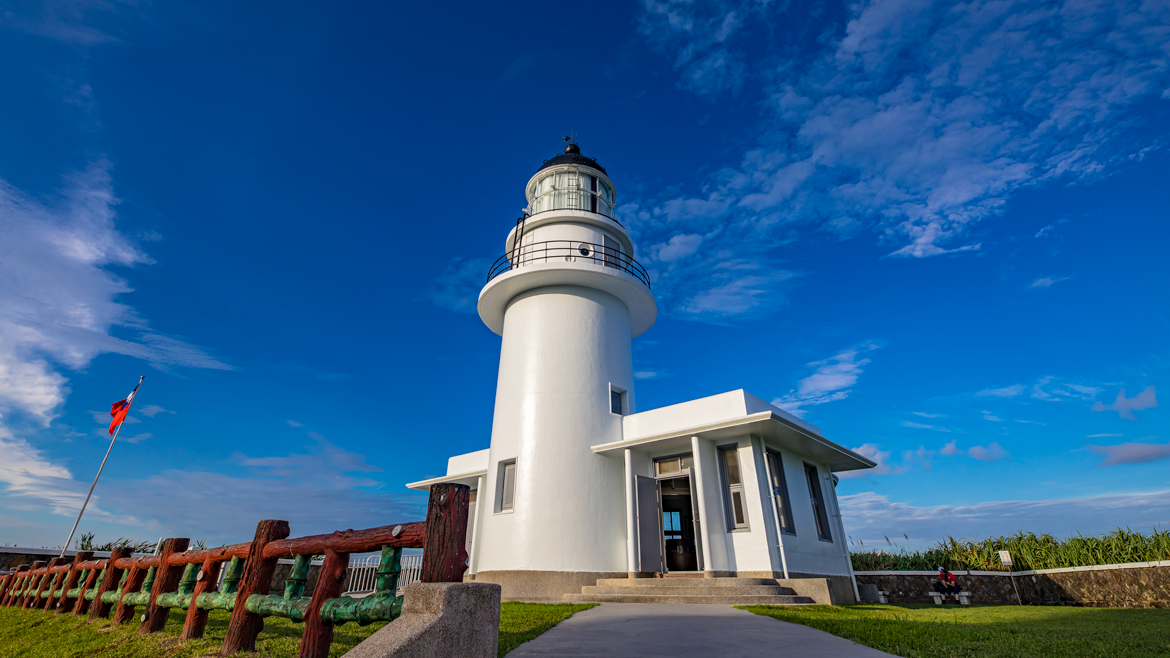
Bitou Cape
The extremely narrow and wonderfully picturesque Bitou Fishing Harbor, on the west side of Bitou Cape, is tucked into a narrow inlet backed by high cliffs. The coastal highway, here serving as the fishing settlement’s main street, squeezes through right beside the water. At the village’s east edge you’ll see a pedestrian overpass and a narrow road leading up onto the cape (the highway zooms across the cape through a tunnel). This road ends at the Bitou Elementary School and the beginning of the Bitou Cape Trail.
The long walkway moves along the cape above the cliffs on its east side, providing an exciting outlook toward Longdong Cape and Sandiao Cape beyond. It ends at the cape’s tip, where a proud white lighthouse stands 120m above the crashing surf (the structure itself is 12.3m high). It was erected by the Japanese in 1896, and given its present form after Allied bombing in WW II.
Unfortunately the last section, providing lighthouse access, is currently closed. Nevertheless, other thrills still await. Steep side trails take you up to the cape’s highest point, down into a west-facing valley and converted army barracks now home to a sun-drenched café, and down the cape’s east side to the rocky shore, defined by stone platforms and other strange-shaped eroded landforms.
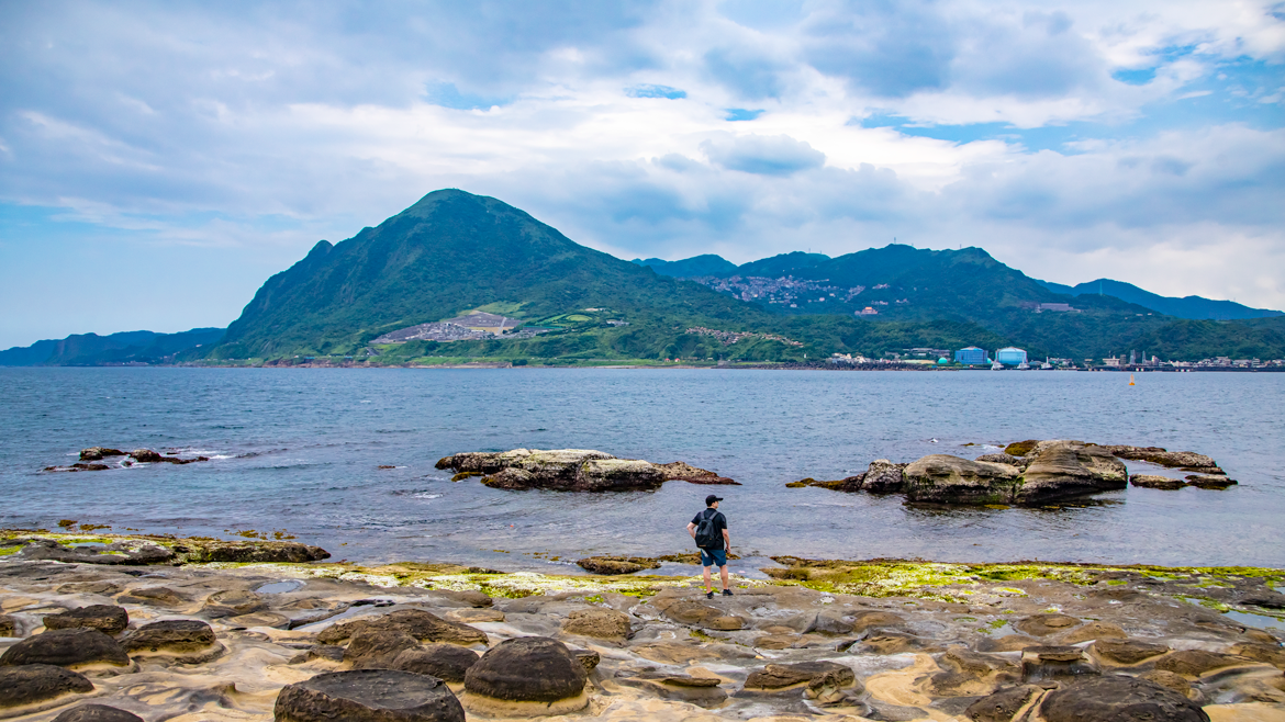
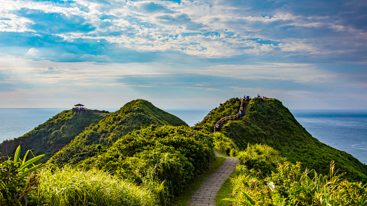
Longdong Cape
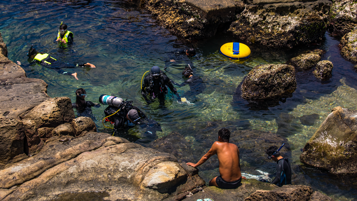
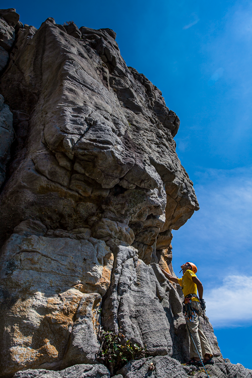
The sheer rock cliffs that run much of the length of Longdong Cape provide some of Taiwan’s premier rock climbing. They are primarily made of sandstone, and soar 40m and higher. The Northeast and Yilan Coast National Scenic Area Administration can provide assistance to those looking for a reputable climbing-guide outfit (website at end of article). Note that the Longdong area also has north Taiwan’s best diving/snorkeling. Whether climbing or not, take time to explore along the rugged rocky area between cliffs and sea, where the pounding surf and shore fishermen staked out on dramatic perches present prized photo opps.
Equally dramatic – and even more panoramic – visuals are to be enjoyed atop the cape, along the Longdongwan Cape Trail, which stretches about 3.5km. There are informative signboards with good English along the way, and pathways down to the shore. “Longdong” means “dragon hole,” and you’ll get a fine bird’s-eye view of said giant dragon cave, carved from a cliff by wave action.
Longdong Four Seasons Bay
Longdong Four Seasons Bay, also called Longdong South Ocean Park, is beside the highway immediately south of Longdong Cape. Serving as an outdoor nature-education center combining seaside fun with learning, the visitor center houses an informative exhibit on Northeast Coast geology and marine life. Along the shore are a series of side-by-side natural seawater pools of ever greater depth (lifeguards always on duty); three are converted former abalone-cultivation ponds. Coral reefs a little further out keep the waters calm. Among the other on-site facilities are a café and small hotel.
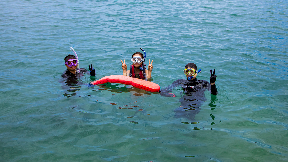
A great way to get up close and personal with the resident tropical fish, shrimp, crabs, starfish, and sea anemones is a snorkeling experience. Note that instructor-guided diving and stand-up paddleboarding (SUP) experiences are also available (separate fee for each activity; minimum 2 people). All your snorkeling equipment is provided: snorkel, mask, protective footwear, life jacket. You start at the dock at one of the deeper pools, learn the basics from your instructor, and when ready you’re taken out into water up to 10m deep, by the coral reefs. A session lasts about 90 minutes. There are both change and shower facilities right by the dock area.
Longdong Four Seasons Bay (龍洞四季灣)
Add: No. 48, Hemei St., Hemei Borough, Gongliao District, New Taipei City
(新北市貢寮區和美里和美街48號)
Tel: (02) 2490-1000
Website: www.kivano.com.tw (Chinese)
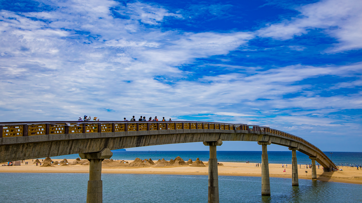
Fulong Beach
This is widely considered north Taiwan’s best beach. It’s located adjacent to Fulong village, at the placid Shuang River’s mouth, just a short walk from the quaint Fulong Railway Station. There are all kinds of water-fun facilities available. Just upriver is the large Longmen Riverside Camping Resort, which has extensive recreation facilities. One is a kayaking center, offering beginner classes and guided river and sea outings.
Each summer the beach is the venue for two large-scale happenings that draw visitors in great numbers, the Fulong International Sand Sculpture Art Festival and Ho-Hai-Yan Gongliao Rock Festival.
The Fulong area is also known for two other things: old-style boxed lunches and high-quality cycling opportunities. Traditionally, “railway biandang” – the Mandarin Chinese word is from the Japanese bento – were sold to railway passengers. There is a cluster of biandang eateries outside the train station. Also around the station are bike-rental enterprises; the most popular area cycling route is the 22km Old Caoling Circle Line Bikeway.
Fullon Hotel Fulong
This seaside hotel, behind Fulong Beach, is a 5-star facility with both hotel-room and villa accommodations. The entrance to the Fulong Beach paid section (i.e., the better-sand, full-amenity section, reached via the pedestrian-only Rainbow Bridge, which jumps the Shuang River) is right beside the hotel. Entry is free for hotel guests.
In terms of active fun, the hotel has on-site indoor and outdoor pools, a fitness center, and a children’s playground – and both spa and sauna facilities for those feeling less energetic. Besides the beach access, off-site fun amenities include bicycle rentals and both guided SUP and boogie board outings, the latter two also available to non-guests.
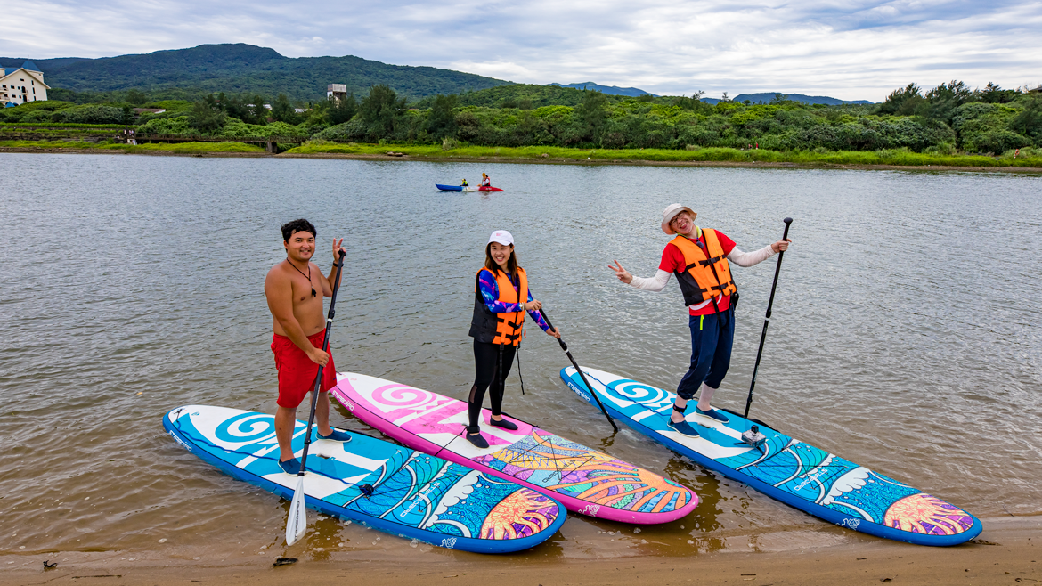
You have two SUP-sortie choices – an hour on the river behind Fulong Beach or an hour on the sea in front of it. Staff deliver the equipment to waterside: your board, paddle, special sock-like waterproof shoes, and life jacket. Your instructor provides a demonstration on technique, then once you get the hang of things in a few feet of water, heads out with you to deeper waters. Though getting the hang of things takes a little longer at seaside because of the (gentle) waves at Fulong, staff recommend this option because of the superior coast/mountain views.
Fullon Hotel Fulong (福容大飯店福隆)
Add: No. 41, Fulong St., Fulong Borough, Gongliao District, New Taipei City
(新北市貢寮區福隆里福隆街41號)
Tel: (02) 2499-1188
Website: fullon-hotels.com.tw/fl/ (Chinese)
BOOK A ROOM (BOOKING.COM)
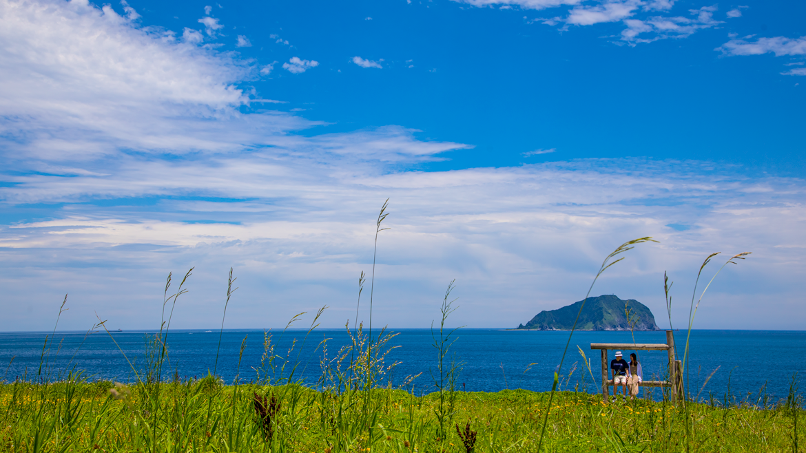
Sandiao Cape
Stand at the tip of Sandiao Cape and you stand on the island of Taiwan’s easternmost point, jutting far out into the Pacific. The “Sandiao” is a phonetic rendering of the Spanish “Santiago.” In the early 1600s, when the Spanish arrived to launch their Taiwan colonial adventure, before settling on Keelung as their base they first scouted this spot, naming it San Diego Cape. They moved on after determining the swirling currents here were too treacherous.
The Sandiao Cape Lighthouse is inland off the coastal highway. There is a sign with clear English at the entrance of the narrow road that heads up the hill. The lighthouse was built in 1935 by the Japanese after two Japanese ships were wrecked directly offshore. It houses a small display gallery with old lighthouse equipment, maps, period photos, and other items. There are short, well-maintained pathways around the lighthouse, one leading to a fine lookout with information boards that have English explanations of the immediate area’s geology and history.
Off the coast far to the south you can see a giant turtle headed out to sea. This is Turtle Island, which recent research has indicated is an active – though decidedly somnolent – volcano. Looking down at the shore area directly in front of the lighthouse, you see abandoned neat-grid aquatic farms where abalone was once cultivated in abundance. A visit to the farm facilities, tiny hamlet, and tiny port here is an enjoyable window into the traditional local economy. You’ll thereafter immediately recognize the region’s many other abalone operations during your travels.
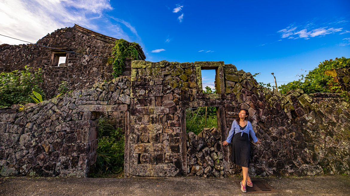
Mao’ao Village
Reward yourself for all your vigorous physical exertion and your intrepid exploring with a leisurely hour or more in the easy-going village of Mao’ao, an old fisherfolk settlement that is now experiencing a tourism renaissance. The coastal highway moves around behind it, on higher ground; a number of narrow roads lead toward its heart, a small open plaza beside the water. In days past this square was used for such fishery-related activities as auctions, drying and mending nets, etc.
Look past one end of the plaza and you’ll see the small harbor and, beside it, an ornate temple that seems far too large for such a small community. Its size is testament to the wealth hauled ashore during the village’s halcyon days. Look past the plaza’s other end and you’ll see examples of another key Mao’ao tourist attraction – the ruins of century-old stone houses built by the local fishing families. The quality of the stone cuts reveals the relative status of the families; clean cuts with neat fitting for the residences of the local elite, rough cuts with more mortar used for the less successful.
The village’s youngest tourist attraction is the line of four eateries/cafés at the back of the plaza. Oldest, most eye-catching, and far the most popular is the Mao’ao Ocean Service Station. Four years old, it is in a stone building that was originally a fishery warehouse. The signature dish is neritic squid and prawn in vermicelli soup. Another bestseller is the Thai chicken.
Mao’ao Ocean Service Station (卯澳海洋驛站)
Add: No. 1-1, Fuxing St., Gongliao District, New Taipei City
(新北市貢寮區福興街1-1號)
Tel: (02) 2499-1617
How to Get There and Get Around
A number of stations on the North Link Railway, which runs from Taipei to Hualien City, are on the coastal strip explored in these pages. Trains run frequently, with local-service trains used in the manner of a bus service. Taiwan Tourist Shuttle (taiwantrip.com.tw) hop on/hop off buses on the Gold Fulong Route also cover much of this article’s area, running between Ruifang Railway Station and the Taiwan Tourism Bureau’s Fulong Visitor Center. Folding bikes are allowed on these buses (though not recommended weekends/holidays).
For more information, visit the Northeast and Yilan Coast NSA website (www.necoast-nsa.gov.tw) and New Taipei City Travel site (tour.ntpc.gov.tw).
Other articles about the Northeast Coast
NORTHEAST COAST Train Ride — from Fulong to Toucheng
KAYAKING at Fulong on the NORTHEAST COAST
CAOLING HISTORIC TRAIL on the Northeast Coast