
Forest Walks and Indigenous Villages in Hsinchu’s Jianshi Township
TEXT / AMI BARNES
PHOTOS / RAY CHANG, VISION
The largest of Hsinchu County’s administrative districts by area, mountainous Jianshi Township is also its most sparsely populated. Humble homestays and wild walks can be found hidden among its vast expanse of densely forested slopes – perfect for world-weary travelers looking to break free of city confines.
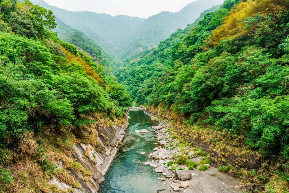
At the confluence of the Naluo and Jiale rivers stands a huge weatherworn boulder. It is one of the first sights to greet travelers after entering Jianshi Township from the west. Strong, immovable, unyielding in the face of nature’s challenges, the Atayal tribesfolk – who still comprise the majority of Jianshi’s population – admired the rock’s indomitable spirit so much that they named their home in its honor. The name continues in Chinese – “jianshi” means “sharp rock.” These days the township’s inhabitants occupy small pockets of livable land where they mostly engage in agriculture (peaches and bamboo shoots are the region’s primary crops), or tourism. Visitors, meanwhile, are drawn to the territory’s ruggedly pretty terrain, tribal villages, clear waterfalls, and forests that are home to millennial tree giants.
Content
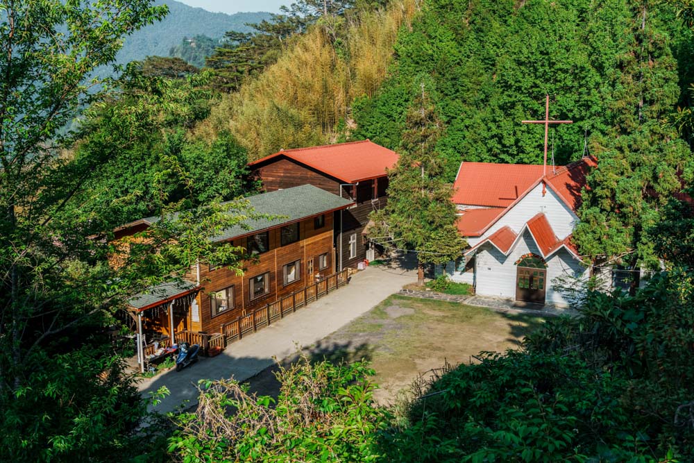
Smangus
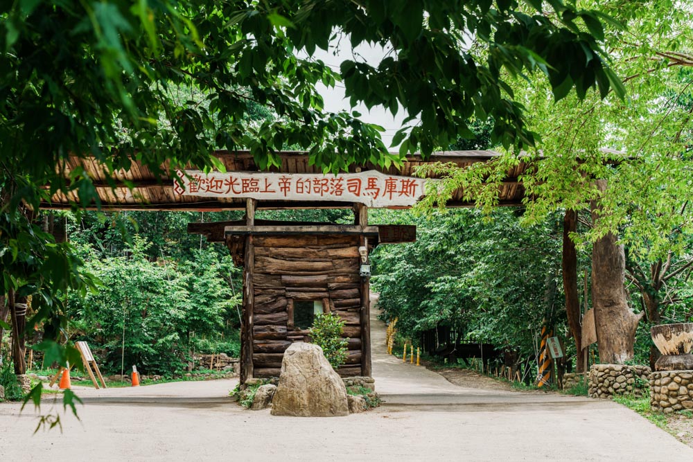
The village of Smangus (smangus.org; Chinese), which, depending on where you get your information, may have been named after a type of oak that grows abundantly in the area or after the leader who established the settlement, has gone by several nicknames over the years. Outsiders labeled it the “Dark Village” and the most remote tribal settlement in Taiwan, referencing the fact that it had neither mains electricity nor a road connection to the world until 1979 and 1995, respectively. However, the 170-odd Atayal villagers who call it home prefer the more salubrious epithet of “God’s Tribal Village.”
Many sources credit the 1991 “discovery” of a giant cypress tree grove for transforming the village from a farming hamlet into a sightseeing spot. In truth, the trees, which are huddled together in a sheltered stream valley, sit along one of the villagers’ old hunting routes, so perhaps calling it a rediscovery or reconceptualization of their value is more accurate. Either way, before that, Smangus had been facing the same sad decline as other remote rural communities throughout Taiwan – a lack of job opportunities and the hardships of rural living had drained the population of its youth. But, to butcher a proverb, when life gives you remoteness and nature, why not make an eco-tourism tonic for the city-bound masses? News of the ancient trees’ existence spread, more people began visiting, and this planted the seeds of Smangus’s rebirth as an eco-travel destination.
The process was not without growing pains though. Competition supplanted the more collaborative way of life that Atayal communities traditionally adhered to. Neighbors began fighting to entice customers to their homestays and restaurants, and – dismayed by these squabbles – tribal council members proposed the radical solution of running the village as a cooperative enterprise. After all, if group efforts had filled the villagers’ bellies for centuries, surely that philosophy could be made to fit the modern world – the tribal unit’s communality and hospitality superseding hunters’ stamina and cunning as essential skills du jour.
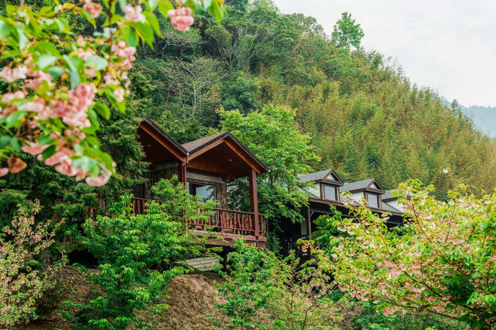
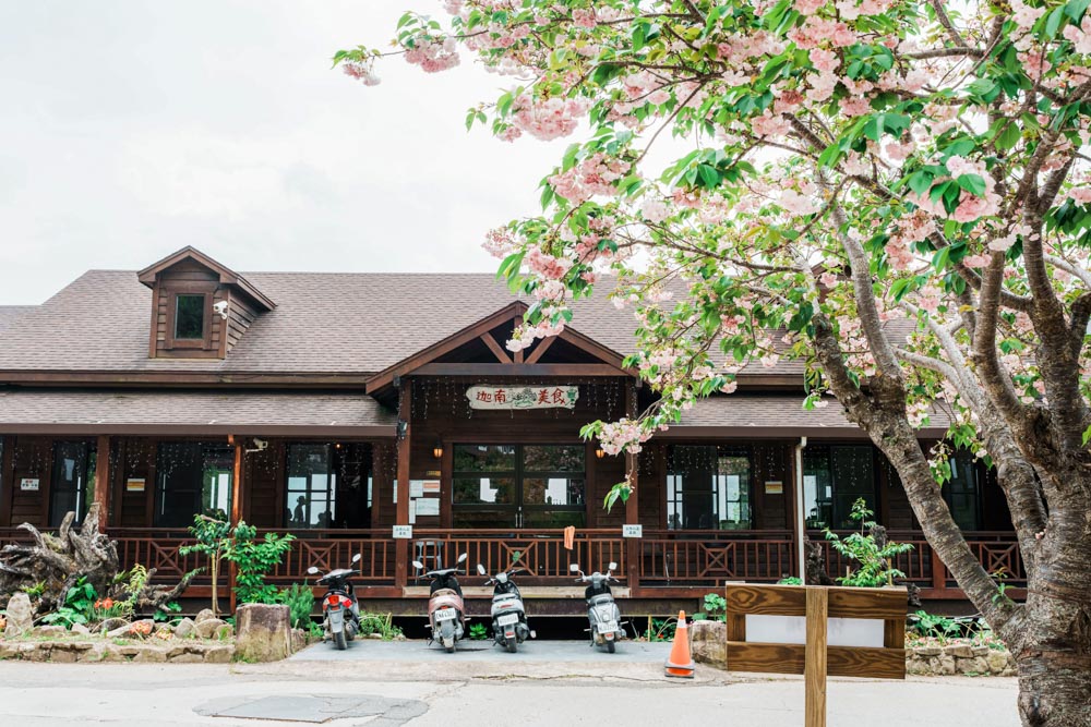
Nearly a quarter of a century into the experiment, its success is reaping dividends. Around 80% of the residents have opted into the program, receiving a monthly stipend and benefits in return for working a rotating roster of year-round and seasonal tasks. The result is something unique among the indigenous communities-turned-tourist attractions that I’ve visited in Taiwan. There is no performative indigenousness on display here, and travelers who go seeking such may come away disappointed. Instead, you’ll encounter locals just going about their daily work, and it feels like you’ve been welcomed into an indigenous family-run B&B that has been scaled up to the size of a village.
Given its remoteness, getting to Smangus is still something of a mission. There’s no public transport, and the drive, which follows County Highway 120, then Township Road 60, and then a winding concrete track that’s barely worthy of being called a road, takes a good couple of hours from Hsinchu City. The somewhat arduous nature of this journey means that many visitors prefer to hire a driver, and most choose to make the trip worthwhile by spending the night in the village.
Room rates vary from around NT$1,500 for a midweek twin room outside peak periods, to NT$6,000 for a double with valley views during the February-March cherry blossom season. Reservations can be made by telephone (03-584-7688), and if you plan to eat at the village’s sole restaurant, you’ll need to prebook your meals (same telephone number). It’s also worth pointing out that, in line with the waste-reduction principles of eco-tourism, guests are asked to bring their own toiletries (only towels are provided).

Giant Tree Trail
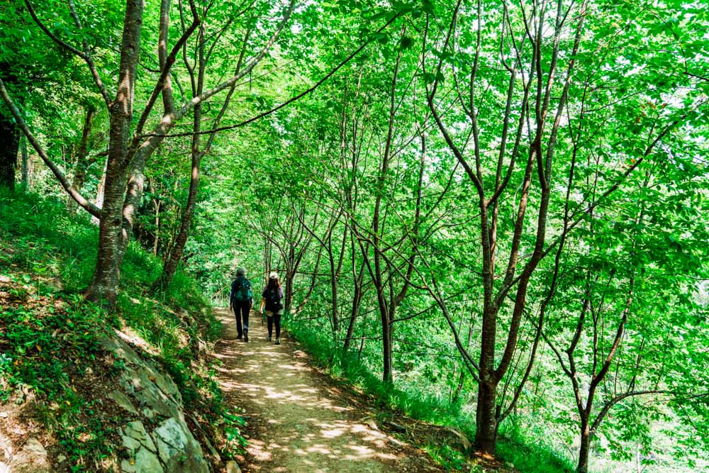
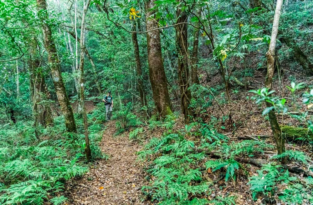
Aside from the village itself, the Giant Tree Trail is the number one draw for visitors to Smangus. The trail takes 4~5 hours and consists of a roughly 5km walk out, followed by a 1km loop through the giant tree grove, and return the same way. In total, you’ll cover a little under 500m of elevation gain, and while there’s some moderate exposure to heights, walkers are never at any risk of a fall. The path underfoot is mostly compacted earth or loose gravel, there are no turnoffs or unclear sections to navigate, and rest areas and bathrooms can be found along the way.
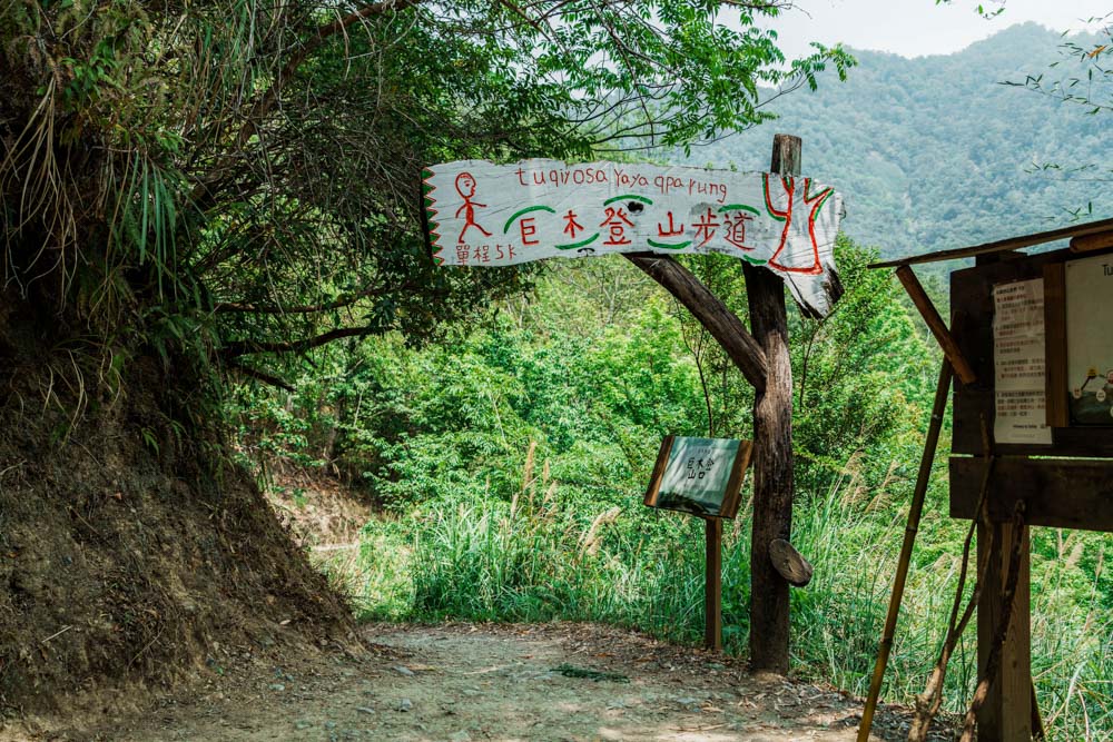
The above details mean the trail is generally considered easy, but, as with all wilderness pursuits in Taiwan, an outing still demands careful preparation. The weather in mountainous regions can change on a dime, especially during the thunder-prone summer storm season, so check and double-check the weather forecast before setting off. Similarly, due to the elevation (1,500~1,600m above sea level), you can expect the air to be considerably cooler than in lowland areas. The trailhead is located right beside the village’s small general store, so you can stock up before setting off – at a minimum, you’ll want a bottle of water and a snack to keep up your energy levels.
Almost from the moment you leave the paved road, you’ll find yourself embraced by a towering forest of makino bamboo. The culms – each as fat as a coke can – stand tall and straight, upper leaves animated by wind so that they ripple like waves on a restless sea. Bamboo forests have a special type of aliveness. They’re never quiet, always creaking or whispering or groaning. And if you stop to listen on a dry day, even critters as tiny as a spider can clearly announce their presence by clambering over the carpet of papery fallen leaves.
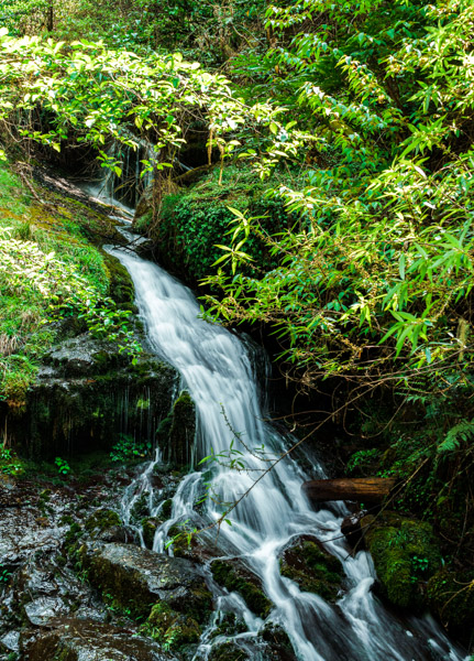
As the bamboo gives way to a more mixed forest, you’ll find yourself crossing a handful of leafy creeks. Foliage beside the trail hides the remnants of an old mushroom-drying hut – a relic from the pre-tourism era, when growing shiitake mushrooms and peaches was the village’s main income source. Further along, a young cherry orchard has been trained into a pretty tunnel, and not far beyond this is a stand of Japanese cedars that were planted to provide trail-maintenance materials.
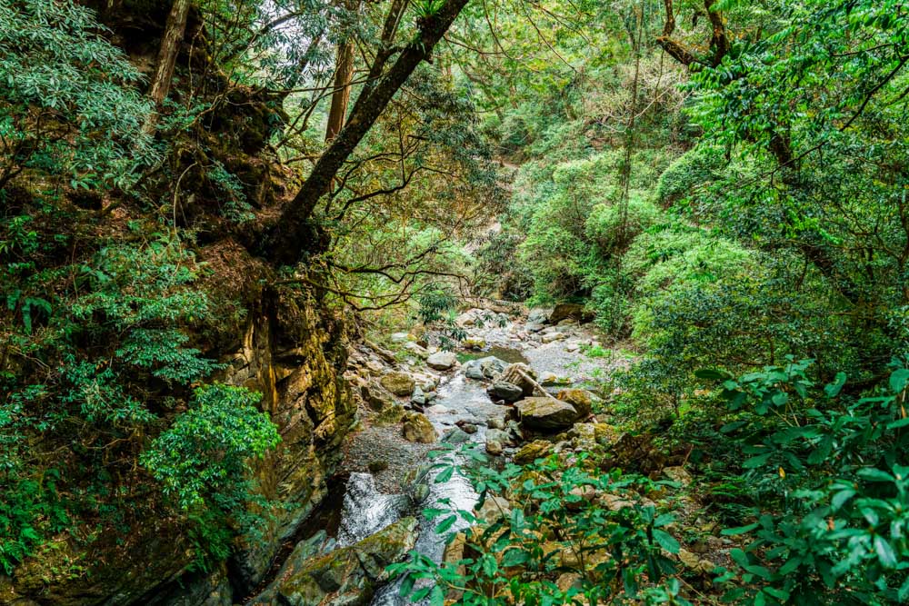
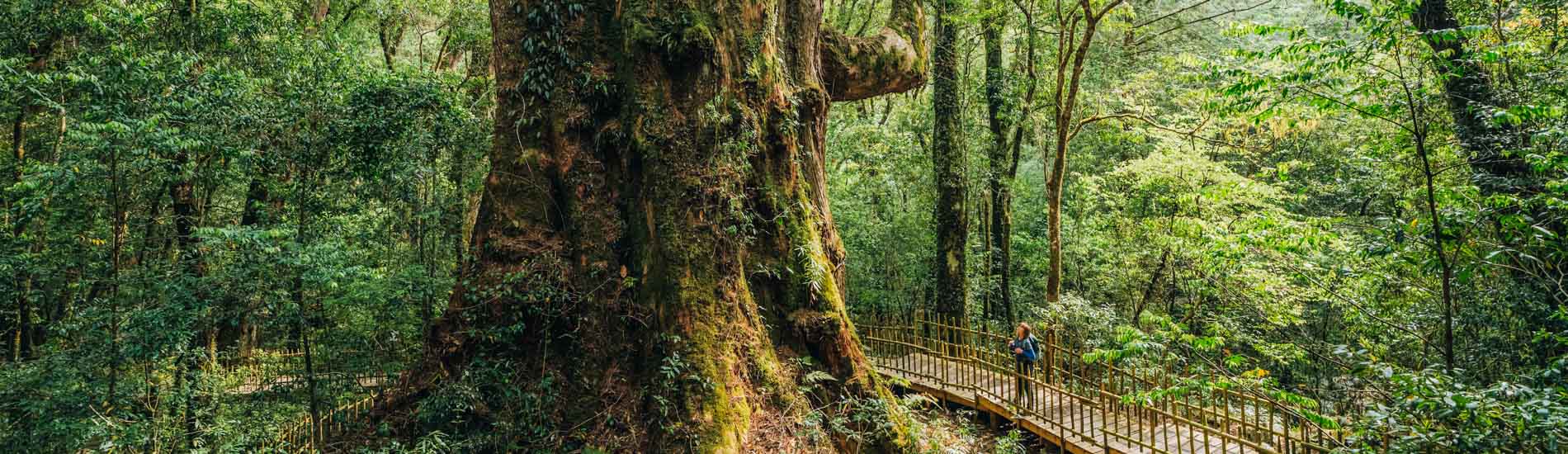
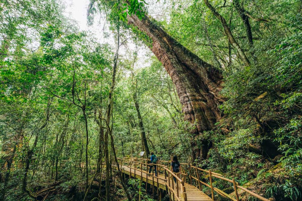
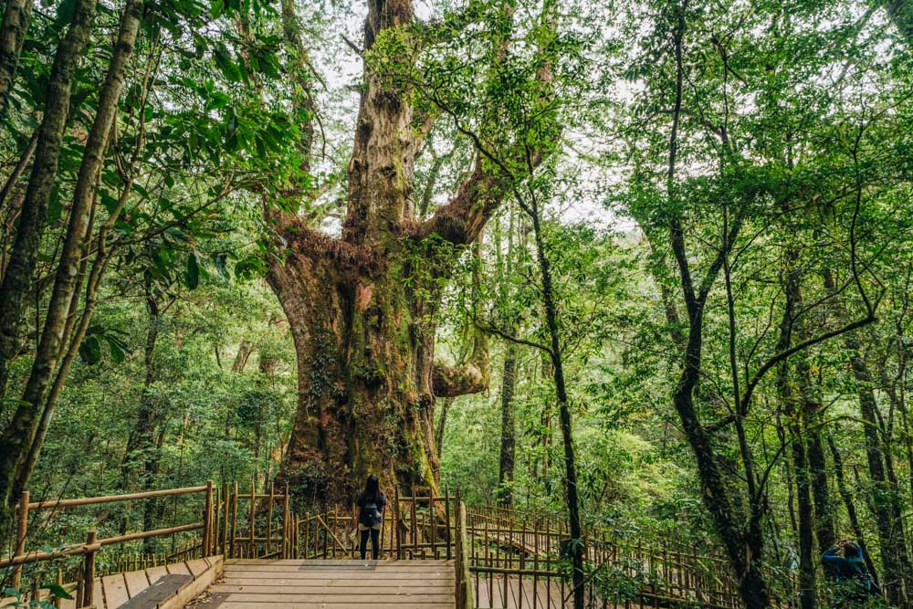
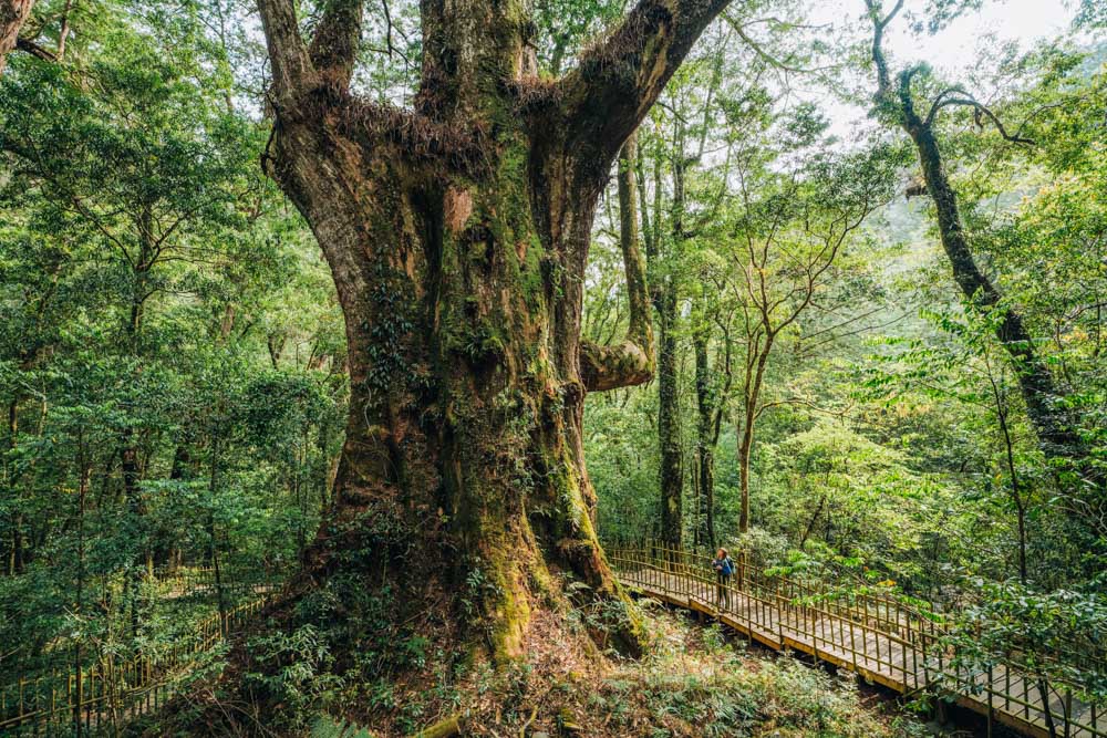
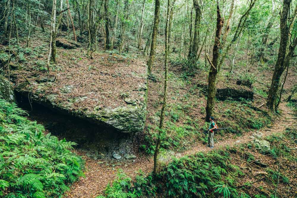
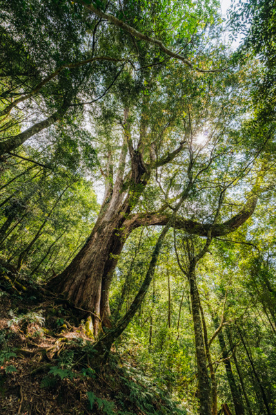
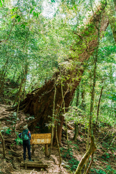
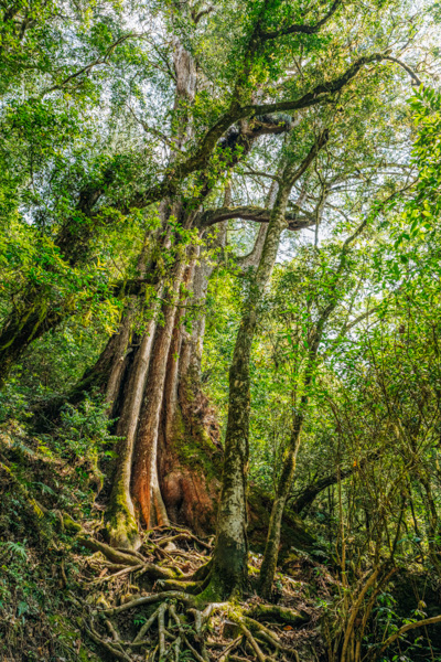
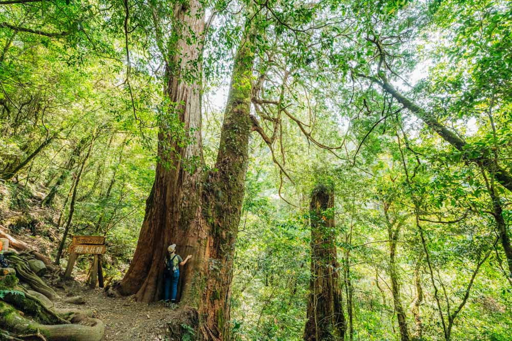
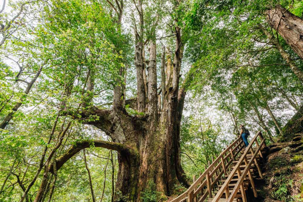
When the sound of running water begins encroaching at the edges of your consciousness, you’ll know that you’re getting close to the giants. The trees have all gathered within a stream valley, the cool waters of which were previously used by hunters to chill freshly caught game. A recently built wooden walkway leads through the giants’ forest kingdom, and 35 of the grandest trees have signs bearing their Atayal nickname as well as information about their species, age, height, and circumference. A 45m-tall Formosan cypress named Yaya is the largest, having spent two-and-a-half millennia growing strong, healthy, and sky-high, her roots headed the other direction and sunk deep in the fertile earth. She is a particularly characterful specimen – with limbs that resemble arms raised in wild gesticulation as if she has been frozen mid-remonstration with the wind.
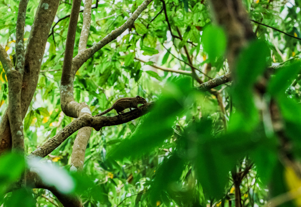
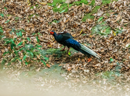
The Travel in Taiwan crew were the last walkers on the trail on the day we visited and, with no one else around, our tardiness gifted us sightings of muntjacs, striped squirrels, and a seemingly fearless Swinhoe’s pheasant. Powered by the excitement of these sightings and thoughts of food, our return journey passed swiftly and, before long, we were enjoying dinner in the village’s restaurant overlooking the deep river valley in which Smangus resides, the village perched high up its north slope.
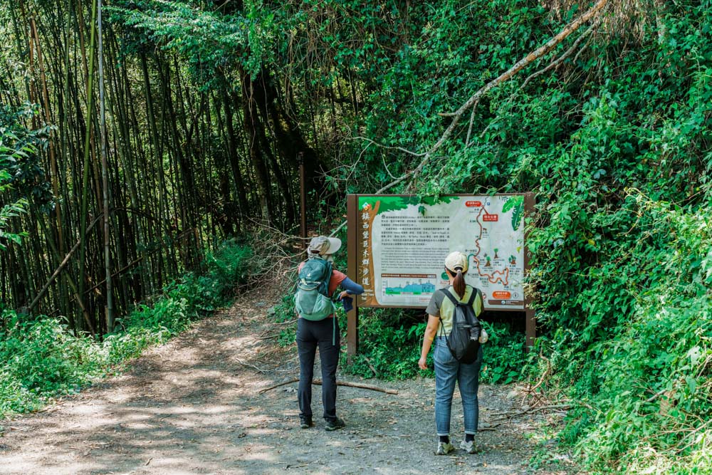
The Giant Tree Trail may be the village’s longest and best-known walk – indeed, it is so beloved by local hikers that it has been voted one of the top 100 trails in Taiwan. However, it’s far from the only option for visitors wishing to explore the area on foot. Maps displayed around the village show a total of seven trails, ranging from 30min short jaunts to 3km walks, most of which require no more equipment than a bottle of water and some comfortable shoes.
Shorter Trails
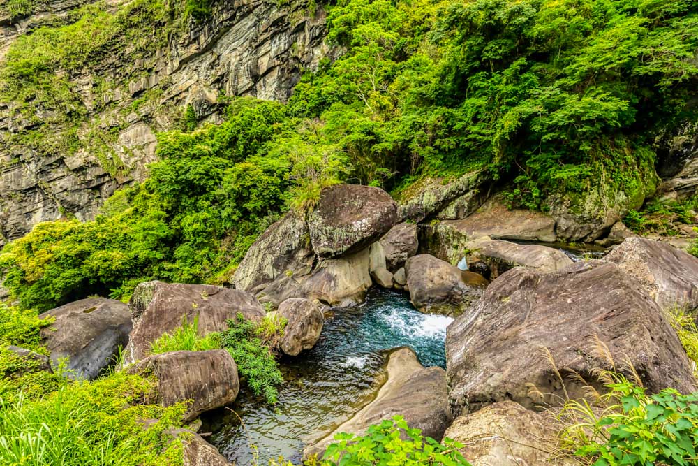
If you visit during the rain-drenched summer months, it would be well worth including a slight detour to the 20m Silifu Waterfall on your trip to see the giant trees. The route adds an extra couple of kilometers onto the walk and involves a bit of a steep descent (and return ascent). But since we went after a dry spell, we decided to skip this and visit a couple of shorter trails on the village’s western fringe instead.
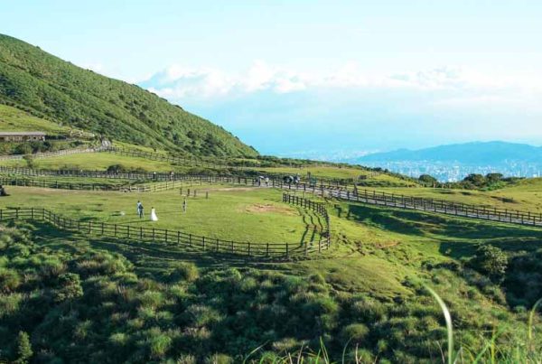
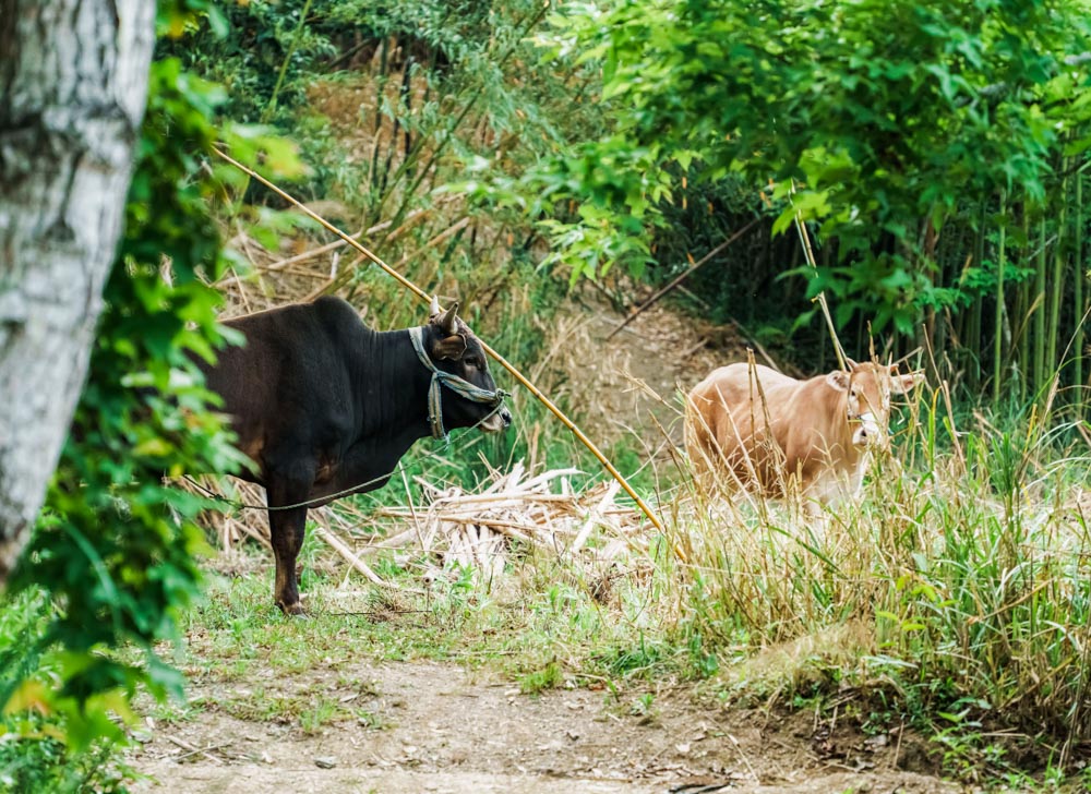
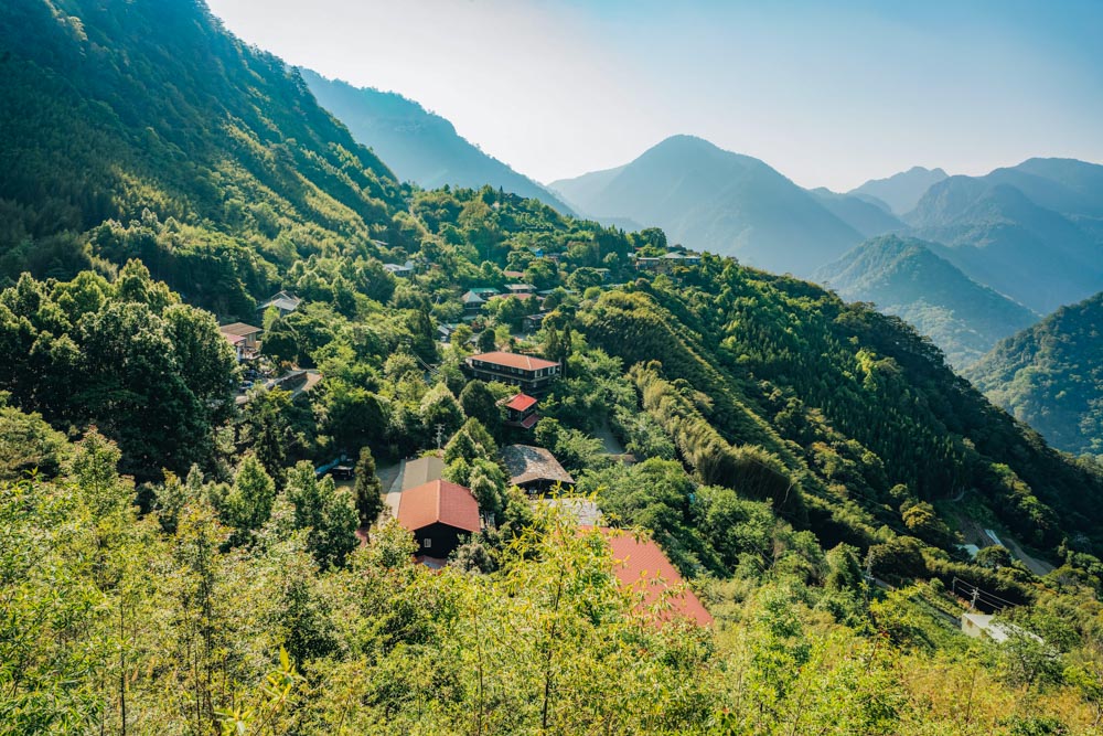
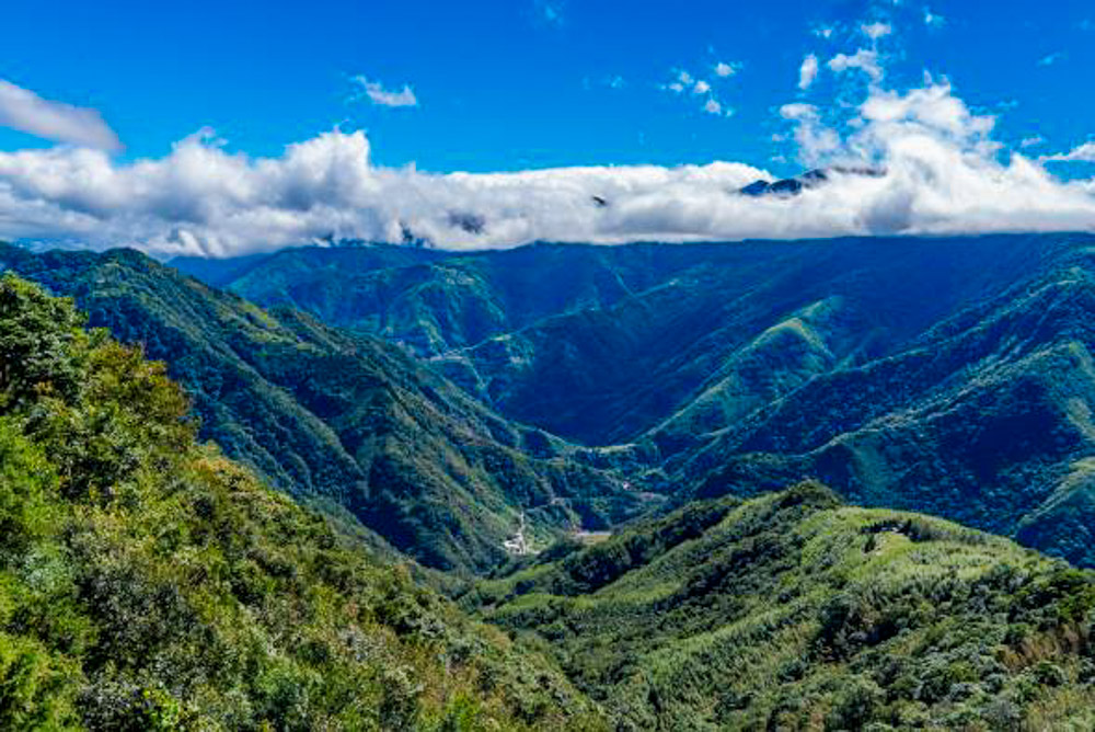
Starting from the visitor center and check-in desk, we followed signs directing us up a lane towards Koraw Eco-Park Trail and towards a viewing platform. As we walked, we found ourselves passing the village’s red-roofed church, then a jerry-rigged pigeon coop. Continuing up, we encountered a pair of cows that swished their tails and eyed us impassively, hard at work producing top-notch organic fertilizer for the village’s crops. After a 10min sweetgum-shaded climb, our feet were kicking up little puffs of dust on a short sandy ridge leading to a wooden observation deck. The platform, which marks the top of the steep Hunter’s Trail, affords hikers a clear line of sight back towards the village. Buildings dot the bamboo-cloaked near slopes, while layer upon layer of origami-like ridges and peaks fill the background. In early spring, this already spectacular scene is transformed into a picture-perfect postcard view as the cherry trees put on a spectacular display of pinks.
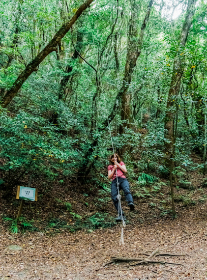
Since the viewing platform is the highlight of the Hunter’s Trail, we didn’t pursue that path any further and instead retraced our steps until we found ourselves at the start of the Koraw Eco-Park Trail. This lollipop loop passes through the villagers’ old millet-growing grounds. The millet plots are long gone, and the area has been returned to the gentle stewardship of nature. The trail is an easy-to-follow 1.5km shady stroll along unpaved paths that are cushioned with the leaves of beeches and oaks. And, at one point along the walk, there’s also a rope swing that demands to be swung upon. (Did I oblige, you ask? Of course, I did.)
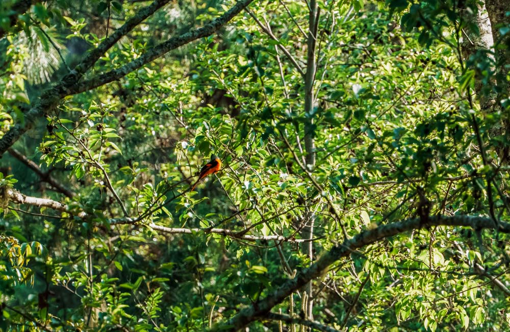
The forest here is known to provide homes and sustenance for a diverse array of wildlife. Intrepid nighttime visitors might glimpse either of the two varieties of flying squirrel that are found in Taiwan, or hear the hoot-hooting of a mountain scops owl. During daylight hours, it’s possible to see deer, squirrels, toads, and an impressive number of birds. In fact, Smangus is a joy for bird watchers. Endemic species and subspecies abound, and you barely need to step off the roads to get spotting. Before the hour hand had reached eight on the second morning of our visit, I had already clocked numerous Taiwan yuhinas, white-eared sibias, a Steere’s liocichla, a green-backed tit, and (a personal lifer) a rusty laughingthrush.
Zhenxibao Sacred Tree Grove
Roughly 8km from Smangus as the crow flies, there’s a second, even grander group of arboreal giants. The cluster is known as the Zhenxibao (or Cinsbu) Sacred Tree Grove, and getting to it involves an even rougher ride than the journey up to Smangus. Fortunately, the route can be broken up with quick stops at a couple of points along the way.
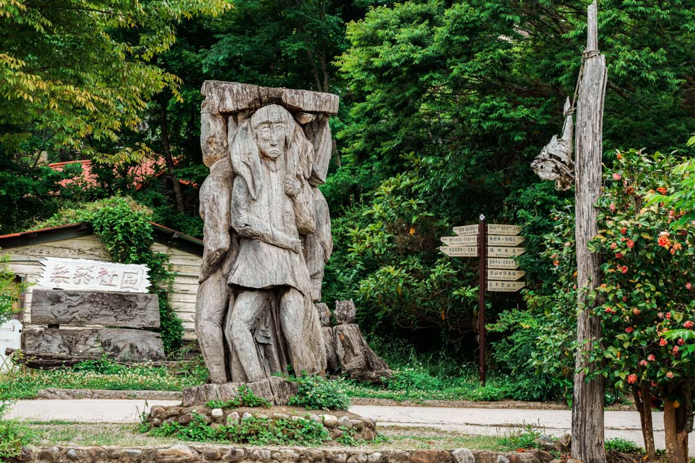
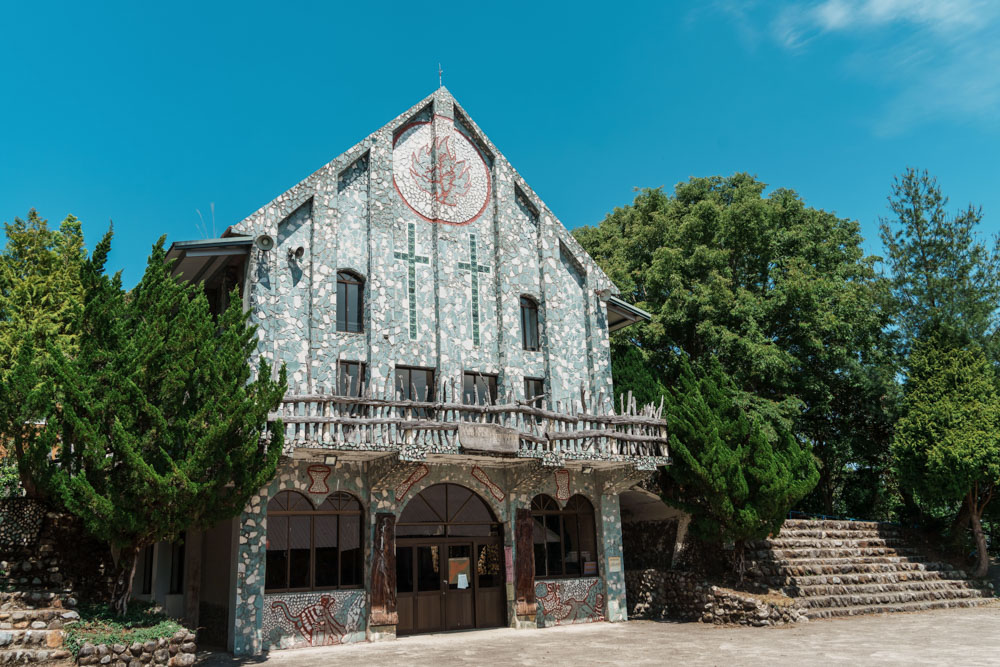
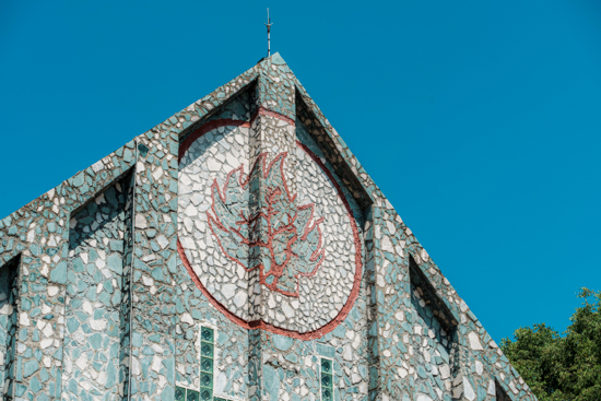
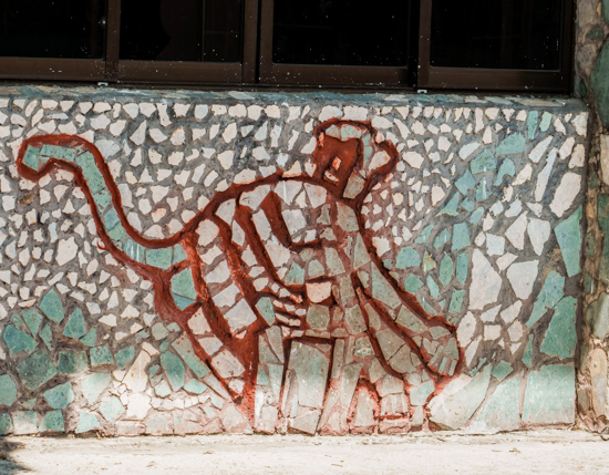
Following Township Road 60 to its southern end will bring you to Xinguang village, where you’ll find a basic convenience store and a preponderance of indigenous homestays offering an alternative to spending the night in Smangus. Another kilometer beyond the village is the option of a brief detour to Zhenxibao Presbyterian Church. The entire exterior of this nearly 80-year-old building is clad in a mosaic of green and white stones – green sourced from the nearby Xiuluan River, while the white is marble recycled from an abandoned house in Hualien. Atayal folkloric characters and motifs are depicted in the stone, and painted on one wall is a mural showing the Christian loaves and fishes parable with characters attired in traditional tribal clothing. All the familiar hallmarks of Christian worship are present – the lectern, the pews, the cross on the roof – but they are colored with a uniquely indigenous Taiwanese flavor.
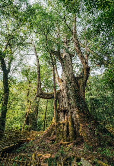
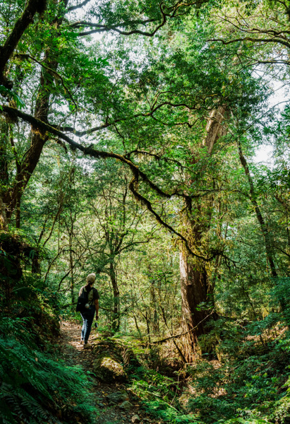
About 25 bumpy minutes from the church saw us arriving at the middle-of-nowhere trailhead of the Zhenxibao Sacred Tree Trail, and with suncream slathered and snacks packed, we wasted no time setting off. The first 30mins were gentle, but then we dipped to cross a stream and the difficulty level picked up a gear from there. At just over 8km, this route is shorter than the Smangus Giant Tree Trail and has a similar amount of elevation gain, but the steeper climbs meant it ended up taking us a full 5 hours.
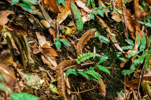
Luckily, there’s more than enough beauty to assuage any tiredness. Carpets of mosses and occasional wildflowers paint the understory while bird’s nest ferns sporting fresh fiddlehead coronets pack the trees, and upon reaching the grove of Taiwan red cypresses, it became clear that the forest had been holding back its best to share with those willing to put in the legwork. As at Smangus, the trees had gravitated towards an area threaded with streams, the presence of water lifting my mood as it tempered the creeping heat and scented the air with a sweet blush of moist, loamy soil. At one point, a patch of forest floor wriggled loose in a quiet explosion of rustling, revealing itself to be a mountain keelback – a non-venomous snake species that extends its hood, hoping you’ll be fooled into believing it’s a big, scary cobra.
The 2km loop through sacred giants took us two hours, much of which was spent with heads uptilted since many trees that hadn’t been officially designated as “giant” towered above us. I can’t help but feel the tools I have for comprehending such lifeforms are woefully inadequate. My initial instinct is to create distance to take in the full scale. But the trees themselves seem to call you closer – as if they know laying hands on their rough, whorling bark and observing the myriad minute and life-filled universes that have taken root in each crevice offers a better way to know the truth of them. But no matter how hard I try, my mind slides back and forth between the micro and the macro, unable to grasp both at once.
On reflection, perhaps I am trying too hard. That these giants quietly continue to exist, ever-ready to welcome us into their mountain abodes, perhaps that itself is enough.
A trip to Smangus and the Zhenxibao sacred trees takes the better part of two days. However, if you’ve already committed to the drive, it seems a shame not to make the most of it – especially since there are more than enough pleasant diversions scattered along Township Road 60 to fill an extended long weekend.
Frog Rock Foot Path
Not far from Neiwan – an old mining town that is worthy of a half-day trip in its own right – the road passes the Frog Rock Foot Path. This easy 2km out-and-back boardwalk follows the course of a waterway as it makes its way to a glass-floored viewing platform overlooking a frog-shaped boulder. Atayal legend tells that long ago, frogs and mosquitos were sworn enemies (as someone who is well acquainted with the local bloodsuckers, I fully support the frog in this matter). One day, a frog chased a swarm of mosquitos into the river valley, devouring them one by one until just a single mosquito remained. The frog pursued that final survivor upstream as far as a waterfall, where the mosquito – able to fly above the cascade – slipped away. The poor frog couldn’t go any further. Thwarted, it stopped in its tracks and just stared longingly after its quarry until it eventually turned to stone.
Access to the trail is ticketed (full price is NT$100), and both tickets and parking are found 1.2km up the road beside a FamilyMart convenience store and a farmers’ market. A shuttle bus service running between the farmers’ market and the trailhead is included in the ticket price, making the walk an ideal half-day adventure for families with kids or individuals who favor shorter, flatter trails.
Yulao Lookout
Half an hour’s worth of driving further inland and uphill will bring you to the Yulao Lookout. This mountain pass, which is a popular destination with pedal and petrol-powered bikers alike, offers big-sky views and a place to grab a quick snack. From beside the adjacent police station, you can look back and westwards over the landscape you’ve just climbed. In the other direction, sharp-eyed observers gazing east in clear weather might be rewarded with a glimpse of Mt. Dabajian (of NT$500 note fame). A smattering of stores cater to the weekend cycling crowd, but parking options are few and far between.
From the lookout, the road snakes down to Xiuluan, a riverside hot-spring village with a couple of suspension bridges strung across the river valley as well as a few hot-spring hotels. Hot water used to bubble up in large quantities from the riverbed here, but heavy rains have changed the landscape, and now the closest au naturel spring is Taigang Wild Hot Spring – an hour or two of river tracing upstream in the dry winter season.