
Hiking Taipei’s Green-Jeweled Crown
TEXT | AMI BARNES
PHOTOS | VISION
When it comes to the many merits of Taipei, the three “C’s” — Convenience, Cuisine, Culture — often take top billing. But if you ask this writer, the city’s greatest draw is its abundance of easily accessible hiking trails and natural scenery. Adventures to suit all ability levels lace the conurbation’s green borderlands. For those planning an exploration of the hills and mountains of Taiwan, the Taipei Grand Trail makes an excellent first step.
In 2018, the Taipei City Government was on the hunt for creative ways to get its population more physically active. Among the ideas put forward was a long-distance trail stitched together from some of the city’s many existing walks. The city authorities were convinced, and the idea was realized. The route spans 92 kilometers of well-kept and well-signposted footpaths split into eight discrete sections, each served by public transport and each doable within 4~6 hours. Since its launch, the Taipei Grand Trail (TGT) – as it was christened – has offered residents and visitors a gateway to health and happiness.
In 2019, the government began collaborating with Hiking Note (a popular local hiking website/app; hiking.biji.co) to boost participation. Hikers who download the app on their phone can amass digital gemstones as they go, and anyone who collects all 56 can use them to apply for a certificate of completion. The year 2024 saw over 7,000 walkers complete the route in its entirety, and over 1,900 of those walked it more than once.
The paths are easy enough and short enough that minimal planning or preparation is required. Grab a pair of shoes suitable for hiking, an EasyCard, a water bottle, and a few snacks, and you’re good to go. Section 2 is the one exception to this; some hikers prefer to wear gloves to protect their hands when using the ropes that aid them through the section. You may also want to download copies of the maps from the Taipei Grand Trail website (taipeigrandtrailen.gov.taipei); however, the signage is generally clear enough that you should be fine without them.
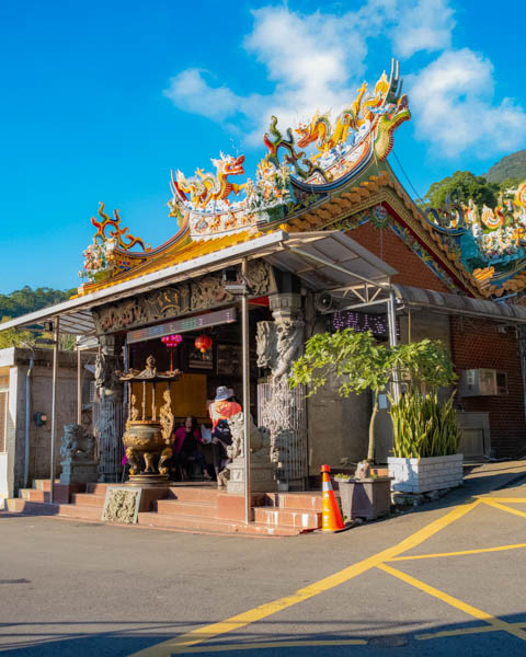
Sections 1 to 5 traverse Taipei’s northern hills. From near MRT Guandu Station (Section 1 here), the trail climbs to meet Taipei’s tallest peak (Mt. Qixing). It passes through a broad swath of Yangmingshan National Park (www.ymsnp.gov.tw) before dipping down to greet the gods at Bishanyan Kaizhang Shengwang Temple and finishing close to MRT Jiantan Station. Meanwhile, on the south of the city, Sections 6 and 7 scale the ridge that shelters Elephant Mountain and pass through the tea farms of Maokong. Section 8 connects the end of Section 7 with the start of Section 1. The 38-kilometer Section 8 bike ride bisects the Taipei Basin, linking up the trailheads to form a full, 130-kilometer loop.
If you want a well-rounded introduction to the city’s wild ways, you really couldn’t ask for more.
From Guandu to Zhuzihu (Sections 1 & 2)
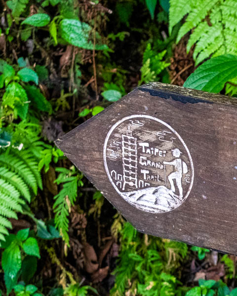
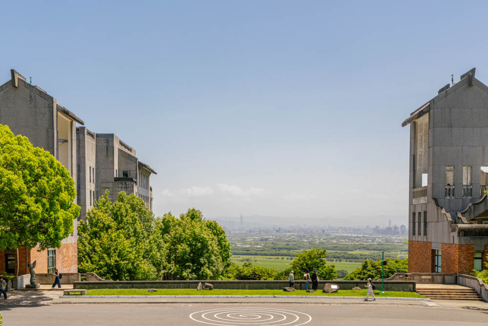
MRT Guandu Station is, as said above, the jumping-off point for Section 1. From here, signage bearing the TGT logo – a hiker approaching a summit with Taipei 101 in the background – directs walkers through the sculpture-filled grounds of the Taipei National University of the Arts. Emerging from the university’s rear gates, the route dives under the cover of trees, making its way onwards and upwards past an oversized grave site, a golf course, remnants of orange groves (the Tamsui area’s orange industry was ravaged by citrus greening disease in the 1980s), and irrigation canals until it reaches Qingtian Temple.
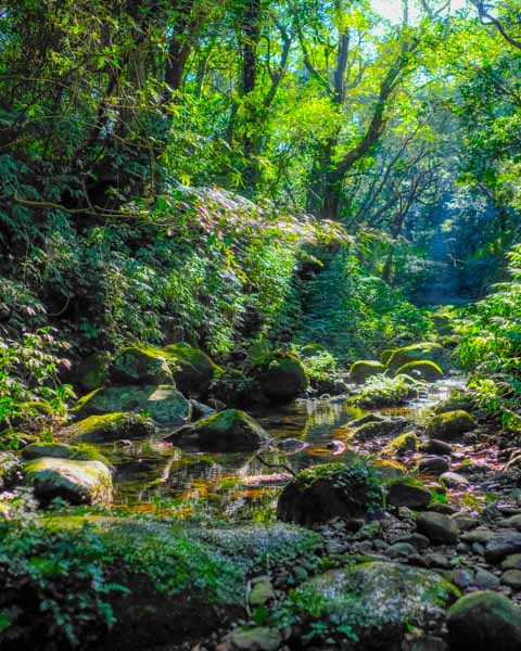
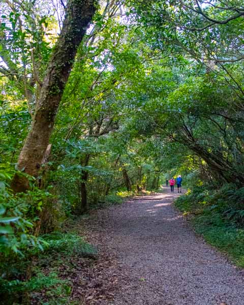
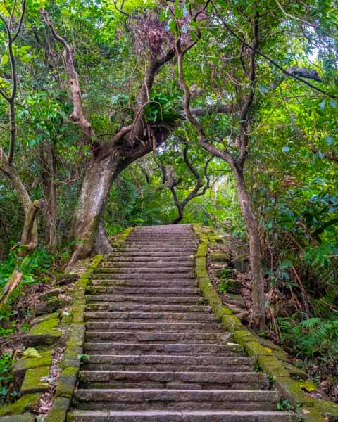
Despite being on the small side, this temple holds outsized importance for TGT hikers because it’s the last pitstop with toilets and a water dispenser before reaching the visitor center at Erziping, an hour or two further along. From the temple, the path climbs steeply, stone steps guiding your feet, while overhead the bamboo knits together to form a green tunnel – half-hidden amidst their whispering stalks are remnants of stone terrace farms and the tumbledown dwellings of the people who once farmed them.

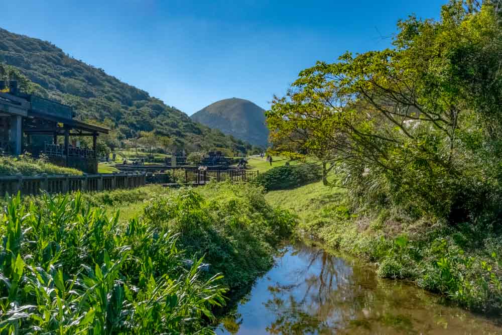
At the top of the steps, the trail begins to level out, and hikers will soon find themselves at Miantianping Pavilion. Section 1 continues straight along a gentle track until it reaches Erziping’s hill-hugged mountain pond and, further on, the aforementioned visitor center and the Balaka Highway, marking the end of the section. Section 2 doubles back from Erziping to the Miantianping Pavilion and then goes up to the peaks of Mt. Datun. Be warned, though, this option is for the uber-fit only – the steps that came before are but a gentle warm-up for what comes next.
From the pavilion, a rope-assisted scramble (a muddy mess in wet weather) brings you to Mt. Datun’s West Peak, then the trail slides down the far side. This pattern – climb, slide, climb, slide – repeats as the trail passes first the mountain’s South Peak and then the Main Peak (1,076m). And though the final ascent is less muddy than the first two, the steps feel especially brutal, coming as they do when your legs are already screaming for mercy.
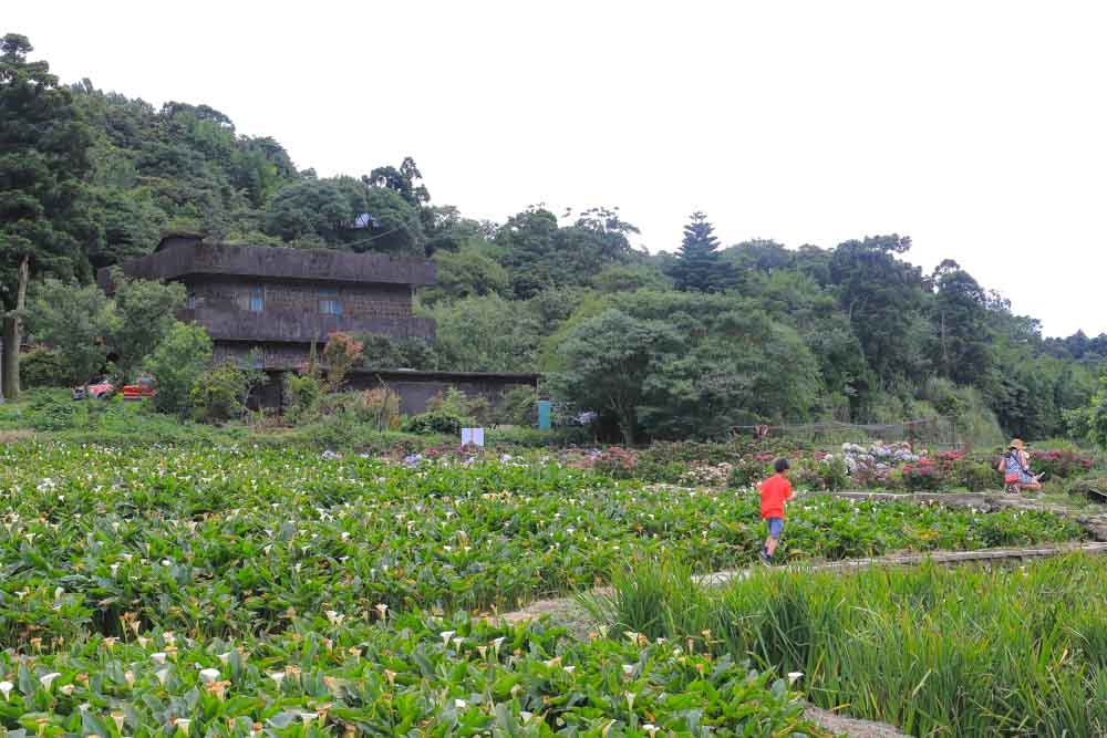
As a final gift to weary walkers, Section 2 concludes by passing through the café- and flower-filled landscape of Zhuzihu, where each April graceful white calla lilies lift their hooded faces to the sky, while in May hydrangeas burst showily with blue, pink, and lilac blooms.
Zhuzihu – Fengguizui (Section 3)
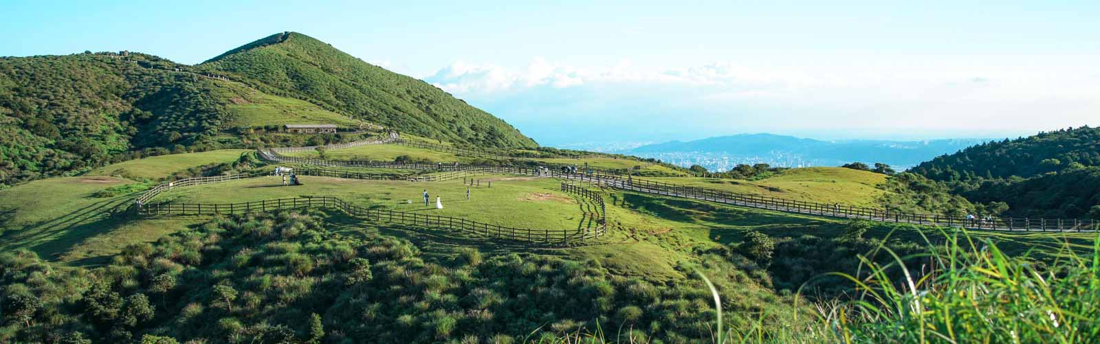
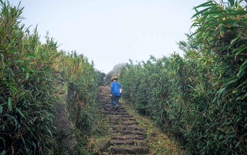
Beyond the floral fields of Zhuzihu, hikers follow Yangming Creek up to a roadway, then head onwards to Xiaoyoukeng Visitor Center, where Section 2 segues into Section 3. Steps (more steps!) lead up through dense arrow bamboo and past smoldering fumaroles to the very top of Taipei, Mt. Qixing (1,120m). The views are cracking (in clear weather), and if you’re lucky, you might meet the resident flock of bamboo partridges. The descent is steeper but equally pretty, and if you visit in November, you’ll be treated to the glorious sight of shimmering, wind-mussed silver grass blanketing the slopes.


To cap off its Yangmingshan romp, the TGT plows on past Lengshuikeng, over the Jingshan Suspension Bridge, and onwards via the water-buffalo-trimmed meadows of Qingtiangang bound for Fengguizui. As you go, look out for a quirky little part of local hiking culture – fellow trekkers will plant sticks in piles of buffalo poo to help prevent the unobservant from stepping in them.
CUST – MRT Linguang Station (Section 6)
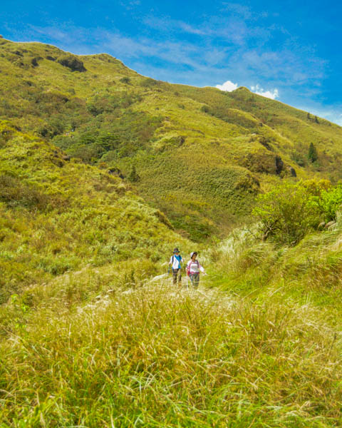
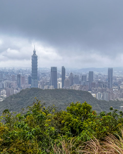
Skipping Sections 4 and 5 and flipping south, Section 6 of the TGT explores the ridgeline that rises like a protective arm cradling Xinyi District’s shiny high-rises. Starting from China University of Science and Technology, steps (yes, again) take you away from a built-up urban area back into the green. Unlike Yangmingshan’s mix of windswept grasses and hardy forest, the lower-elevation shrubbery here is lush and jungle-like, full of frilly ferns and trailing vines.

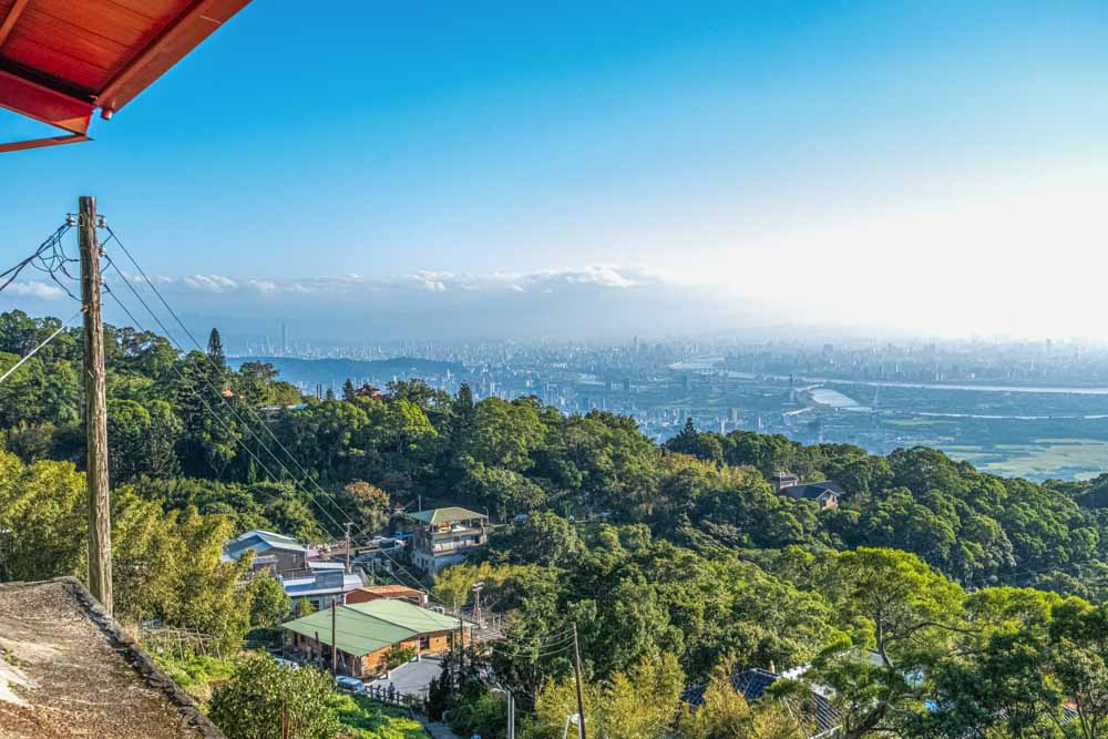
A 30-minute uphill step-fest gives way to a gentler up, up, down, down ridge-back ride. Tidy temples and tea pavilions serve as resting areas, and the further west you go, the more spectacular the scenery becomes. Highlights of this section are the 95 Peak (375m; the highest point of Mt. Nangang) and Mt. Muzhi (320m; “Thumb Mountain”). Located a short detour off the main trail, the rocky bald spot of the latter pokes out from the trees and offers sweeping 360-degree views, and if you know how to read the landscape, you’ll spot many of the peaks covered in earlier sections.
For the remainder of its length, Section 6 falls in step with part of the Tamsui-Kavalan Trails (another of Taiwan’s long-distance routes). It first cuts through a mountainside cemetery and then Fuyang Eco Park before depositing you back in the urban-core streets within striking distance of MRT Linguang Station, where – of course – Taipei’s famed three “C”s are close at hand to reward you handsomely for your efforts.