
And How the Local Train Line Gets You to Them
TEXT | RICK CHARETTE
PHOTOS | VISION
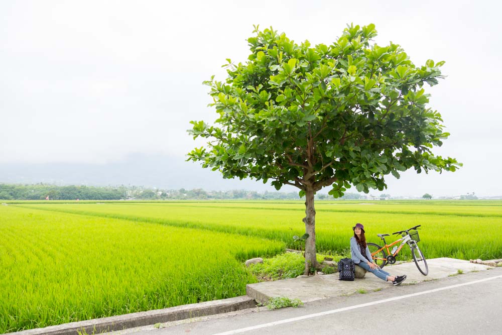
Locals and in-the-know travelers use the inexpensive, high-quality Hualien City-to-Taitung City train service through eastern Taiwan’s gorgeous East Rift Valley like an “in-town” bus service, hopping on and hopping off at local stops. Tour cycling is popular in the flat-bottomed valley, which is carpeted with neat farms, especially rice paddies, and framed by the Coastal Mountain Range on the east and the Central Mountain Range on the west. Let’s see how trains and bikes connect.
Yufu Bikeway
You can take your cycle on the trains – with certain restrictions, of course – and also rent well-maintained bikes at outfits vetted by the Taiwan Tourism Administration within easy walking distance of train stations at numerous stops. There are different levels of choo-choo service – fast trains through milk runs – so be sure there’s actually a scheduled stop at the destination you’ve chosen to begin your cycling play (Taiwan Railway website: railway.gov.tw).
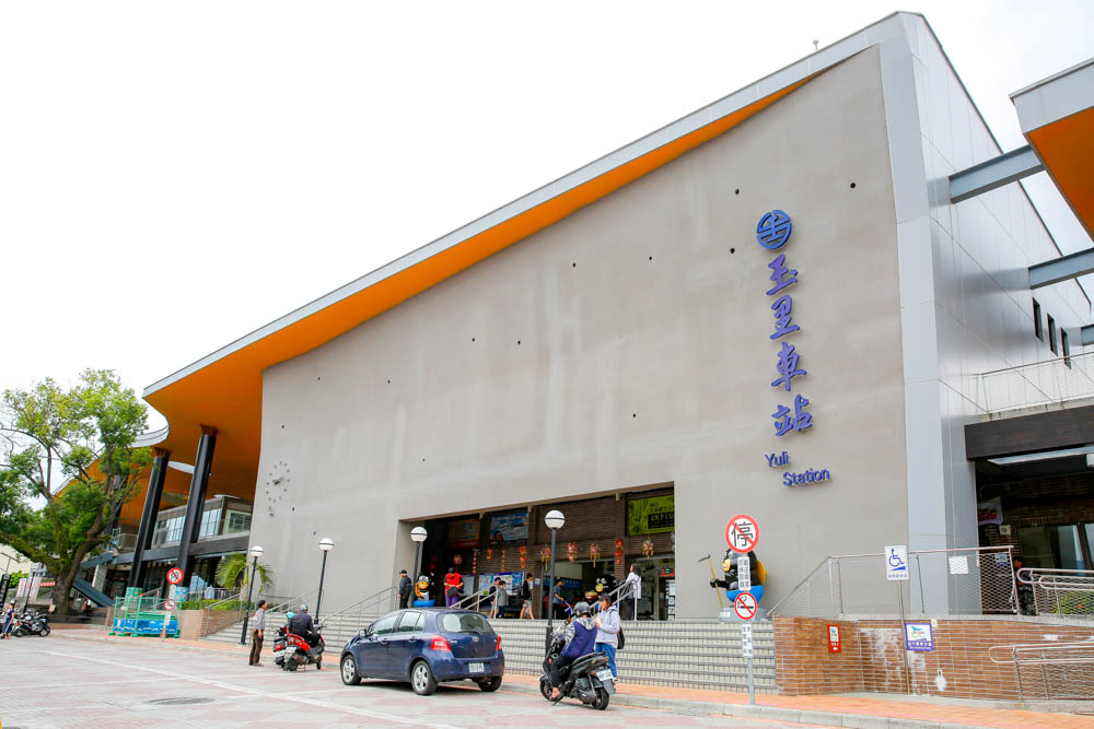
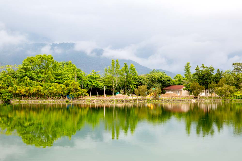
Modern Yuli Railway Station
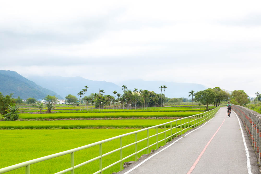
The East Rift Valley’s major roadways are very bike-friendly, with light vehicle traffic and good shoulder space; Provincial Highway 9 has dedicated bike lanes (the major train stations are beside/close to this route). Casual cyclists, however, prefer the valley’s menu of easy-and-breezy dedicated bikeways.
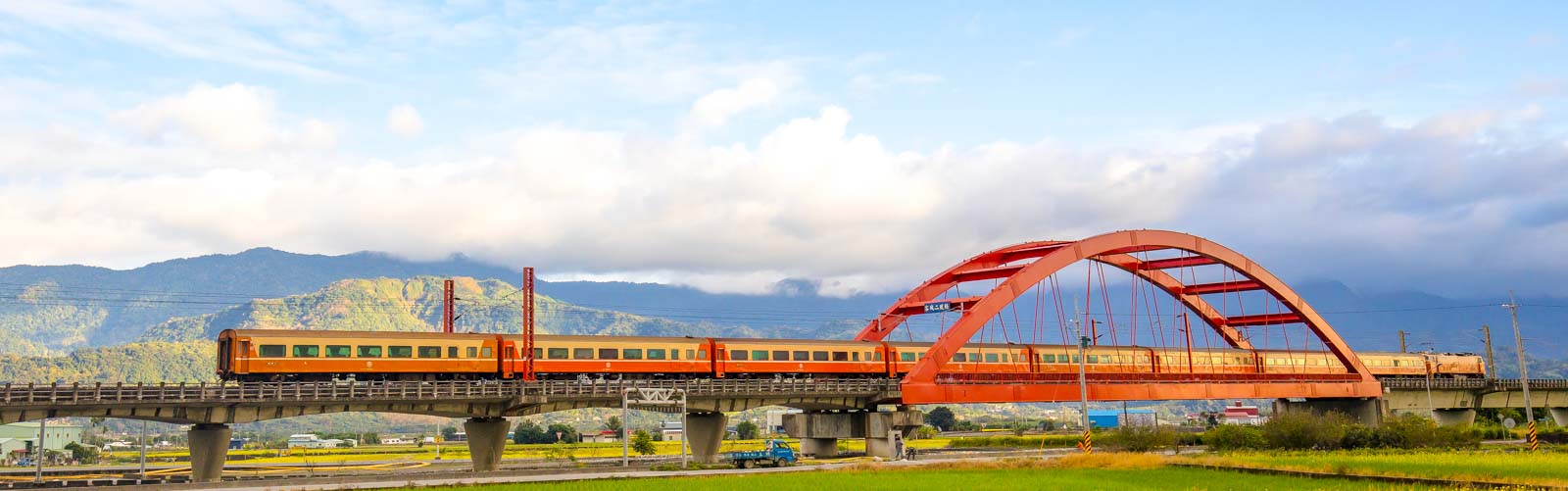
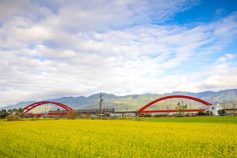
The Yufu Bikeway is a premier, 10km route that straddles the townships of Yuli (the “Yu” in the name) and Fuli (the “fu”), swishing you through a sweeping rice paddy/rapeseed field mosaic. It’s flat, built along a decommissioned railway line section. Yuli is one-two hours south of Hualien City by train, depending on the train service type. Bike rentals are readily available at/around its station. The bikeway starts 300m south of the station, first bringing you alongside the new tracks, then along the edge of open countryside. Recommended right off the bat, however, is a short “detour” from the entrance (continuing south alongside the tracks) to the iconic Kecheng Iron Bridge, a fiery-red/orange multi-arch railway bridge captured by countless photographers – bridge flying over rice paddies, trains flying over bridge, backdrop of soaring mountains.
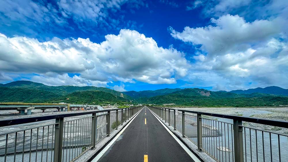
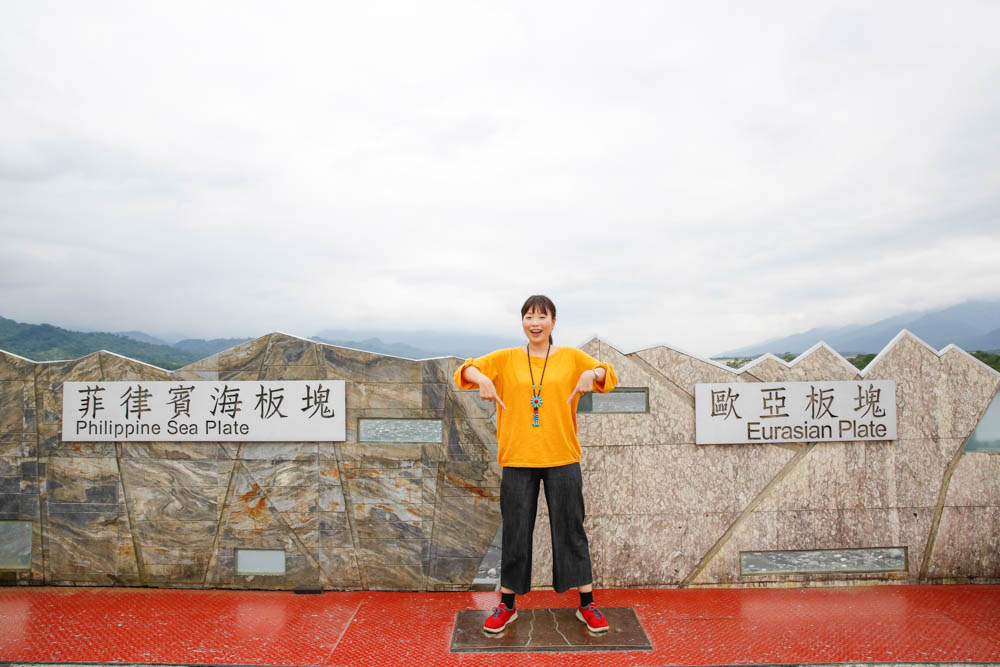
A few kilometers into your ride you’ll come to an old railway bridge. The Eurasian Plate and the Philippine Sea Plate fault line run underneath – as does the Xiuguluan River, flowing north – marked clearly so you can stand with one foot on each tectonic plate. The bridge and railway tracks were put under too much strain by the ongoing plate movements, leading to the retirement of this section in 1989.
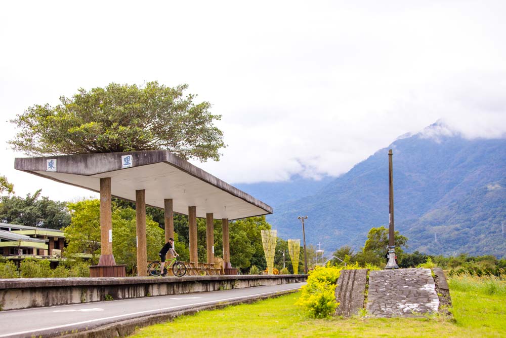
Later on in your ride, a short jaunt up a side valley will bring you to the popular Antong Hot Springs resort area, founded by the colonial Japanese in 1930. By the trailside at the jump-off point is the recently thoroughly renovated old Antong Railway Station, built in 1924, which now features a visitor center and raised viewing deck. This and substantial work on the bikeway were carried out after damage caused by an earthquake in 2022.
The bikeway ends in Fuli Township at the cute, decommissioned, artwork-beautified old Dongli Railway Station, now home to a café with comfy outdoor seating.
Guanshan Town Circle Bicycle Path
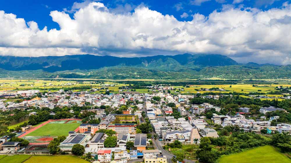
The 15.2-kilometer Guanshan Town Circle Bicycle Path fully encircles the town of Guanshan, about 37 kilometers south of Yuli, 45~60 minutes away by train depending on service type. Like Yuli, Highway 9 runs through its heart, and close by its railway station. There are cycle-rental shops both right outside the station and a short distance away (east), just outside Guanshan Water Park, through which the bikeway runs. Save for a small cluster of residences/guesthouses here, you’re already in open farmland.
The Guanshan loop holds the honor of being the first dedicated bikeway created in Taiwan, in 1997, and remains among the most beautiful. Fruit orchards are added to the valley’s paddy- and rapeseed-field mix. Most riders tackle the route counter-clockwise, heading out from the water park area. Your first section, heading north, brings you along beside the shallow irrigation waters of the gurgling Guanshan Canal, the bucolic tapestry here most likely completed with grazing water buffalo and darting cattle egrets.
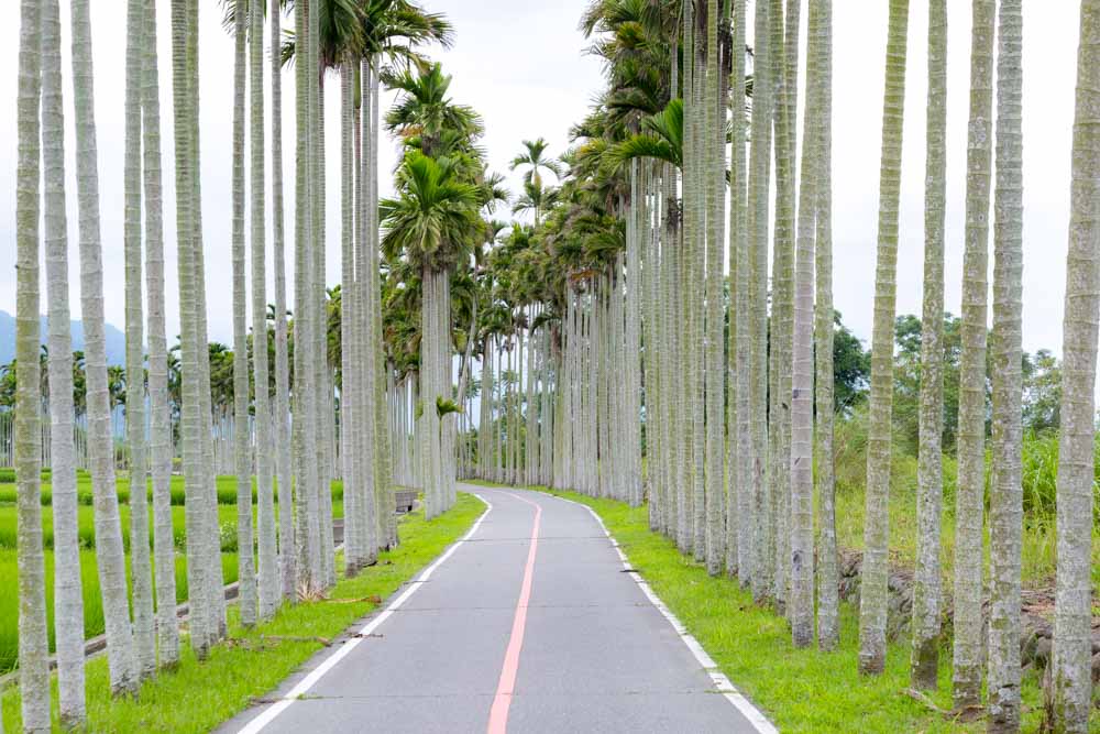
Further ahead, you come to a striking section lined with tall areca (betel-nut) palms. Their long, slender trunks rise like thin columns, betel-nut clusters visible near the crowns. The betel nut, consumed in Taiwan like chewing tobacco for its mild stimulating effect, has long been a part of local agricultural and blue-collar life.
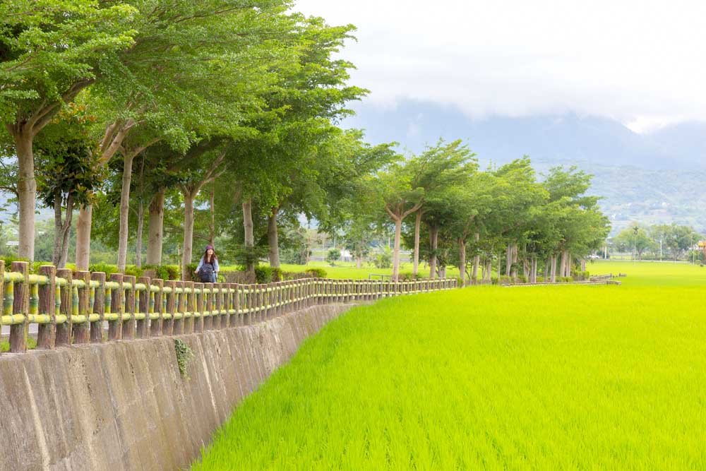
Now, a gentle but steady climb of half a kilometer heading west along a small river that shoots out from a narrow gap in the central mountains. Pace yourself. You’ll end up higher than the town, creating splendid sweeping views eastward over the town and valley. Along this stretch, many riders stop once or twice to wander down the narrow paddy-separation paths or sit atop a stone ledge bordering one of the irrigation channels, contemplating the serene painter’s canvas before them.
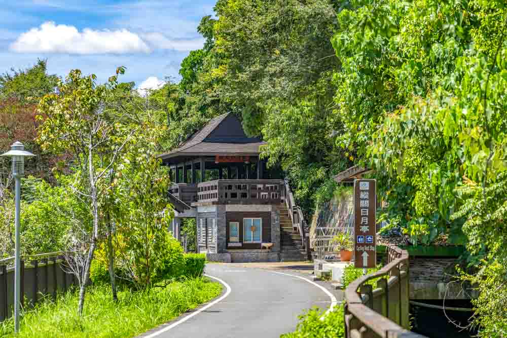
The next stretch, the cycleway’s highest, runs south along the wooded mountainside past the town – on hot days the shade provided here is much appreciated. Along the way you come to a viewing pavilion where a token NT$50 bikeway maintenance fee is collected. For much of this length you’re accompanied by a ditch-like irrigation channel filled with gushing waters fresh from the mountains, the waterway seeming, impossibly, to defy gravity and move up and down with you as you navigate this section’s long, gentle undulations. As you emerge into more open countryside again, fragrant fruit orchards and small range-chicken operations appear.
This section ends at the start of the bikeway’s biggest thrill – a downhill straightaway fully 1km long that streaks you back down into the valley bottom, near the Beinan River, which streams south. Be sure to test your brakes before you launch. The bravest riders – perhaps “most foolhardy” would be the better choice here? … we’ll let you decide after the fact – try to go without brakes till the denouement. Note, however, that a sight that encourages many a rider to slam on the brakes partway down is a trailside strawberry farm where you can sit yourself down on a congenial patio with a cooling shaved-ice treat – the perfect reward for yourself after all that pedaling (assuming you didn’t lazy-option rent an e-bike, of course!).
Your joyride is completed with a leg through the tranquil Guanshan Water Park. Once the site of a large waste site, the attractively landscaped grounds, spread over 32 hectares, are a pleasure to meander through. There are eco-trails, plenteous birdhouses generating great birdwatching, splash areas, fountains, a small artificial lake with paddleboat rentals, a stargazing deck, and other attractions.
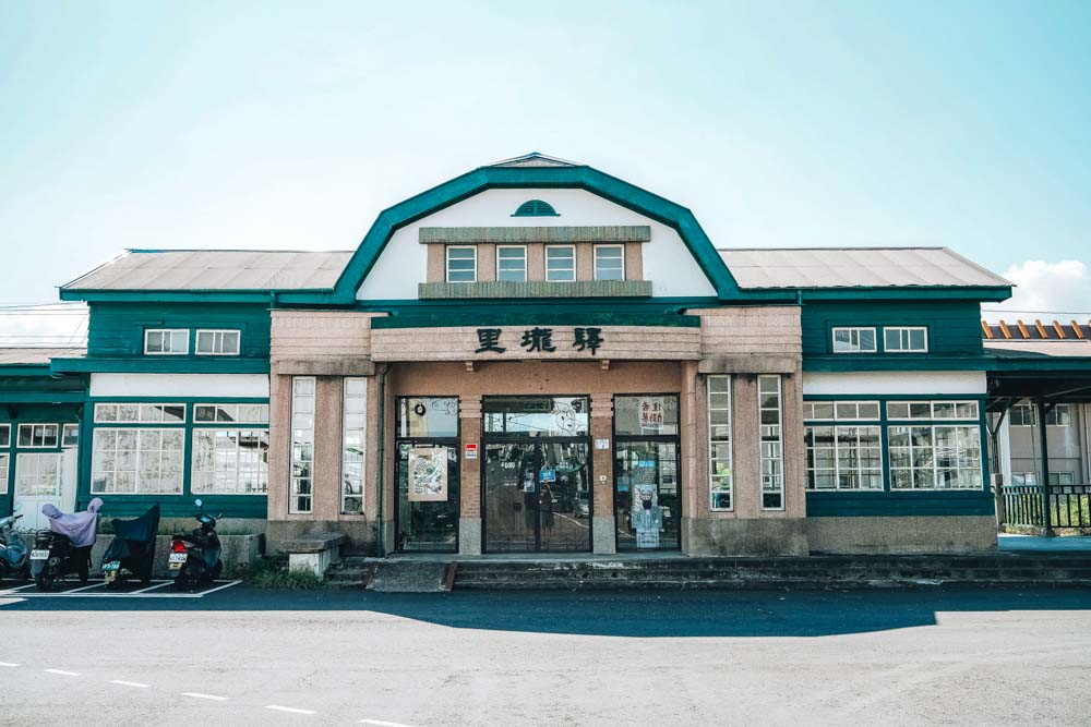
While in Guanshan, several places of historical and/or cultural interest in the town center are also well worth your time. Among these, Guanshan’s old 1919 Japanese/Western-architecture train station, named Lilong Station, is close to the new one, as is the Guanshan Tianhou Temple, the valley’s most important place of Mazu (Goddess of the Sea) worship; the first edition was erected in 1895, the current version in 1930.