
How to Do Scenery-Rich Eastern Taiwan on Two Wheels
TEXT & PHOTOS / VISION
Among the many popular areas for bicycling around Taiwan, the East Rift Valley and the East Coast most certainly make a bicyclist’s heart beat faster, both in terms of pre-visit anticipation and on-the-ground excitement.
Realizing the dream of circling the island of Taiwan using a bicycle is high on the list of local and foreign cycling enthusiasts. Many opt for the well-marked and easy-to-follow Cycling Route No. 1, most completing the ride in less than two weeks. A loop around the island has the benefit of presenting cyclists with a wide range of splendid sights and scenic locations.
If you don’t want to circle the whole island, and would rather focus on those parts especially rich in terms of pristine environment with high mountains seen in the distance and/or the ocean right by your side, spend some time in the marvelous eastern region of Taiwan, specifically Hualien and Taitung.
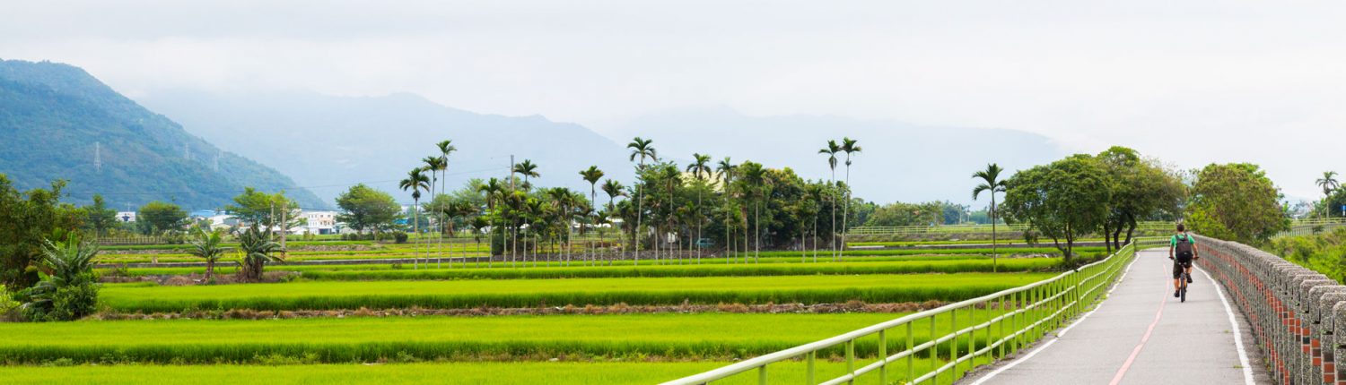
Looking at a topographic map of Taiwan, you will quickly see that in the east there is the Coastal Mountain Range along the coast and the East Rift Valley on the west side of the range. Two highways connect Hualien and Taitung cities; Provincial Highway No. 9 (through the valley) and No. 11 (hugging the coast). There are a few minor roads connecting the two and there is also County Road No. 193, which runs parallel to the 9 in the Hualien part of the valley.
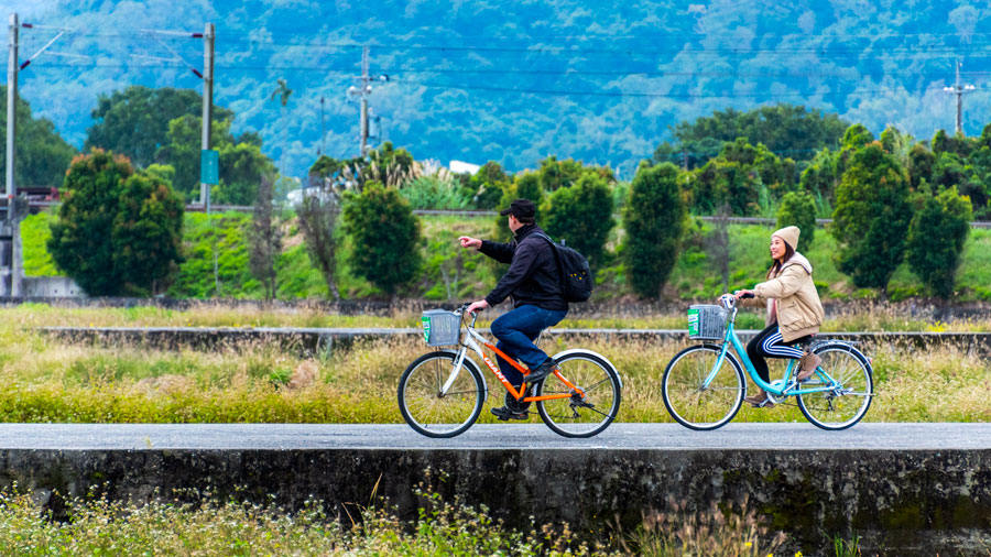
You have quite a few options when it comes to route planning. Ride, for example, the whole length of the valley and then back along the coast (or the other way round), cycle exclusively in the valley or along the coast (or combine the two areas by taking one of the connecting roads), or follow the 193, a great alternative to the main highway, with less traffic and more shade trees.
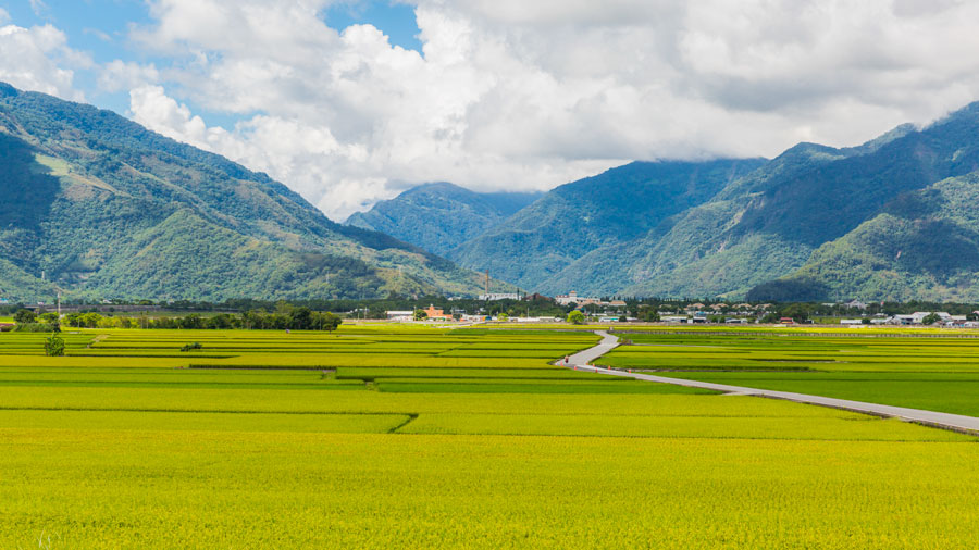
The valley is more convenient in terms of public transport thanks to the trunk railway line that runs its length. If you plan to only cycle parts of the valley, you can easily move about, taking your bike onto local trains. You can also rent bikes near the starting point of some of the well-known dedicated bikeways, for example at Yuli in Hualien and and Chishang in Taitung.
Recommended Routes
Yufu Bikeway
This is a very popular bikeway built on the railbed of a decommissioned railway line. “Yufu” is short for Yuli-Fuli, the two southernmost townships of Hualien County. The bikeway starts close to Yuli Railway Station, where you’ll find bike-rental shops providing both self-pedaled and e-powered bikes.
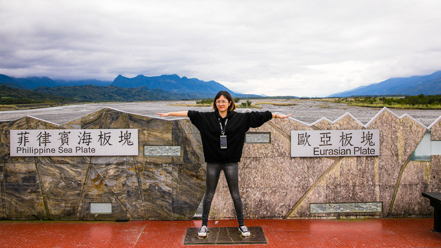
The bikeway starts about 300m south of the railway station. After briefly riding parallel to the main railway line, you’ll soon turn southeast, following the original path trains would take in the past. Two kilometers from the railway station you’ll arrive at a long, straight bridge that crosses the Xiuguluan River, and you’ll find the answer to why the old railway route was abandoned. After crossing about two-thirds of the bridge there’s a point indicating the fault line that runs by directly below, dividing the Eurasian Plate and the Philippine Sea Plate. The ongoing tectonic movements of these plates put a constant strain on the railway bridge, and in 1989 it was decided to re-route the railway line, keeping it on the western side of the river. Good news for bicyclists; the beds of old railway lines make excellent foundations for bikeways.
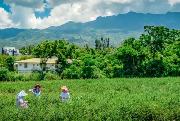
The Yufu Bikeway is a very enjoyable ride through the enchanting East Rift Valley countryside, past rice paddies and rapeseed fields. About 5km from Yuli Railway Station you’ll come to a platform, the only remains of the tiny former Antong Station. (Note: Antong is known for its hot springs, and if you follow Highway No. 30 uphill for about 2km from the station you’ll come to a number of excellent hot-spring establishments.)
The Yufu Bikeway ends at the next former station, Dongli (about 10km from Yuli Railway Station), a great spot to take a rest (there is a café inside the former station building) and recharge before starting the return leg to Yuli.
Taitung City to Sanxiantai
Taitung is a small city in the southeast with a laid-back vibe and strong indigenous-culture presence. It’s the logical starting point for exploring the East Coast from the south. The stretch from the city all the way up to Sanxiantai, a major tourist attraction (about 50km one way), is regarded as especially scenic and attractive. Just to the north of the city you come to the fascinating sandstone rock formations of Xiaoyeliu (“Little Yeliu”), the smaller counterpart to the much more famous “Big” Yehliu Geopark on the North Coast. Less than 2km further you can make a stop at the Jialulan seaside park. This is a great spot for taking a good look at the coast further north, prominently featuring the impressive mountains of the coastal range.

With the highway running close along the shore in this area, you can easily stop at numerous small beaches (sand and pebble) along the way, including Shanyuan and Jiamuzi. Before reaching the village of Dulan, make sure to turn left just off the highway and take a look at the Water Running Upward sight, a small channel in which the water appears as if defying gravity. In recent years, Dulan has become a hotspot for visitors and new residents seeking immersion in the relaxing ways of this small community in close proximity to excellent surf beaches.
The next stop ideal for a rest is the Jinzun Recreation Area, where there is a café with outdoor seating, perched on a high point, perfect for taking in the grand Pacific panorama. In the distance you can spot Jinzun Fishing Harbor, known as one of Taiwan’s best surfing locations. Next up is the village of Donghe, where you should try the yummy steamed buns. When crossing the Donghe Bridge just to the north of the village make sure to look left to see the Donghe Old Bridge and, beyond the bridge, the huge white boulders scattered in the riverbed of the Mawuku River.

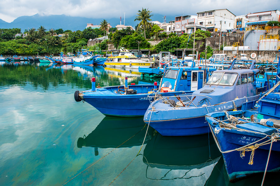
Finally, you’ll enter Chenggong Township, home to the East Coast National Scenic Area Administration headquarters facility, the grounds of which are the venue for the annual Taiwan East Coast Land Arts Festival. Next, check out Chenggong town’s fishing harbor for excellent seafood dining.
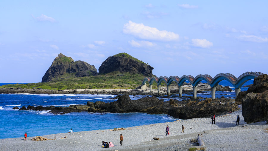
The final highlight of this recommended route is scenic Sanxiantai, a small offshore island connected to the mainland by a photogenic multiple-arch pedestrian bridge.